
© Baselland Tourismus - Bettina Gysin

© Baselland Tourismus - Bettina Gysin

© Baselland Tourismus - Bettina Gysin

© Baselland Tourismus - Bettina Gysin

© Baselland Tourismus - Bettina Gysin

© Baselland Tourismus - Bettina Gysin

© Baselland Tourismus - Bettina Gysin

© Baselland Tourismus - Bettina Gysin

© Baselland Tourismus - Bettina Gysin

© Baselland Tourismus - Bettina Gysin


- Lyhyt kuvaus
-
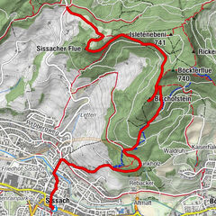
Büchelweg die historische Rundwanderung
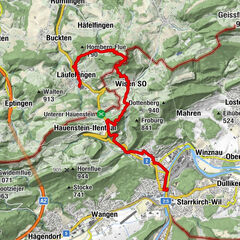
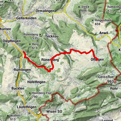
- Reitti
-
Pratteln (296 m)0,6 kmReformierte Kirche1,0 kmGeisswald3,1 kmAdler4,5 kmHof Schauenburg5,9 kmHof Mayenfels7,7 km
- Korkein kohta
- 493 m
- Korkeusprofiili
-
 © outdooractive.com


- Kirjoittaja
-
Kiertue Wanderung Büchel käyttää outdooractive.com toimitettu.
GPS Downloads


Lisää retkiä alueilla
-
Solothurn und Region
1454
-
Baselland
778
-
Pratteln
288