© Tourismusverband Ostallgäu e.V. - Peter von Felbert

© Tourismusverband Ostallgäu e.V. - Peter von Felbert

© Tourismusverband Ostallgäu e.V. - Peter von Felbert

© Tourismusverband Ostallgäu e.V. - Ingrid Rösner

© Tourismusverband Ostallgäu e.V. - Ingrid Rösner

- Lyhyt kuvaus
-
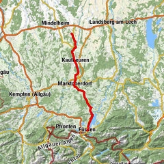
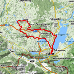
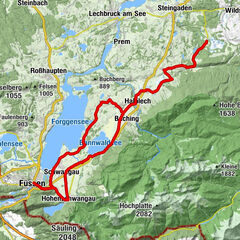
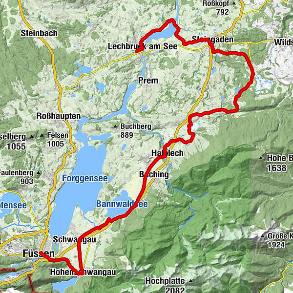
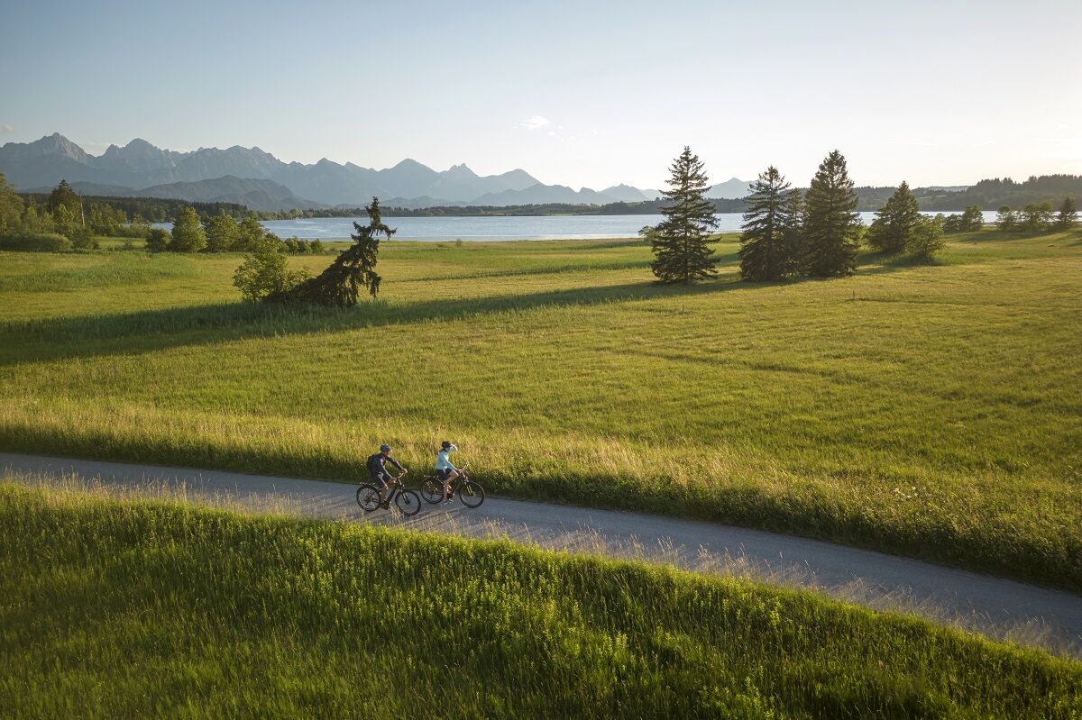
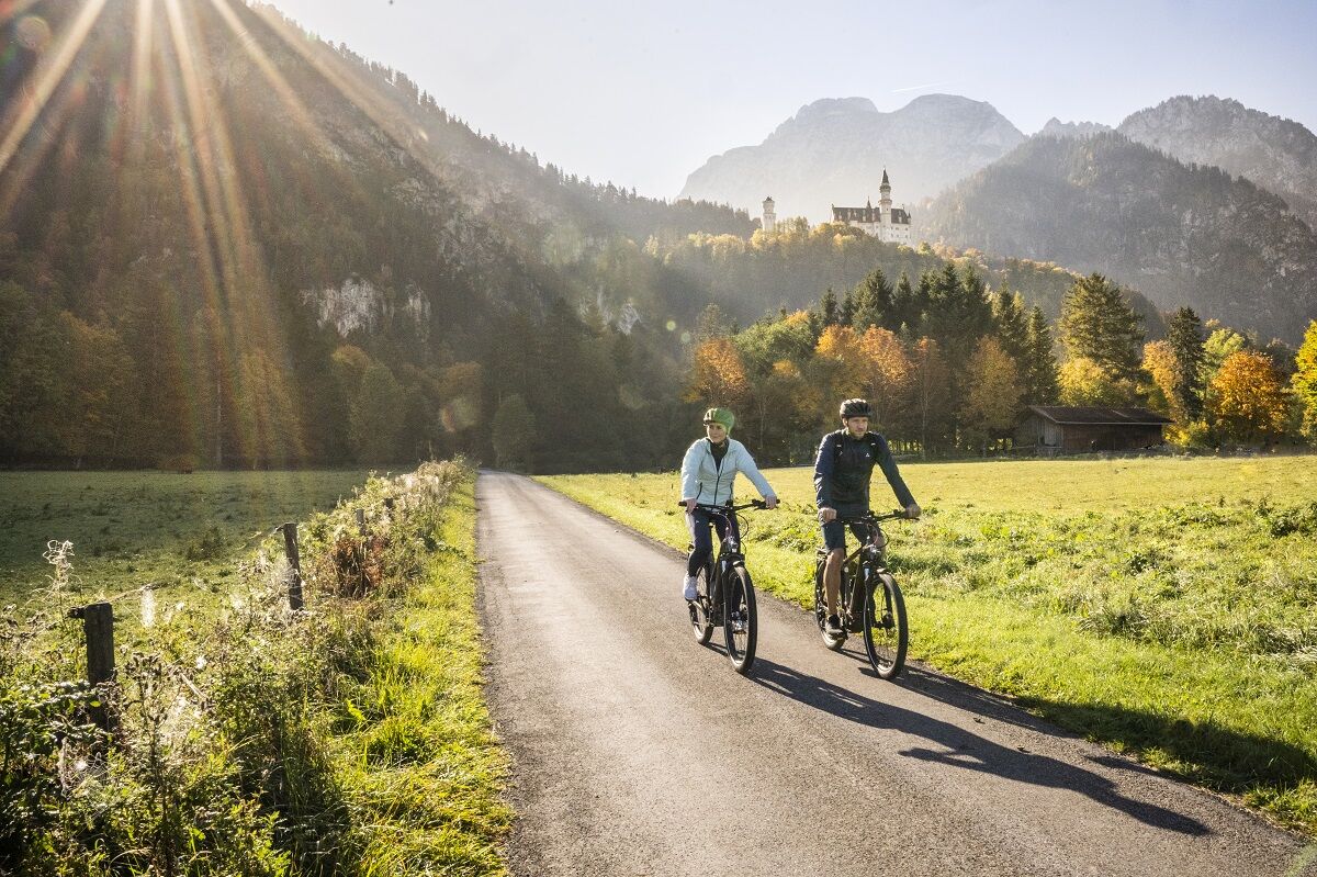
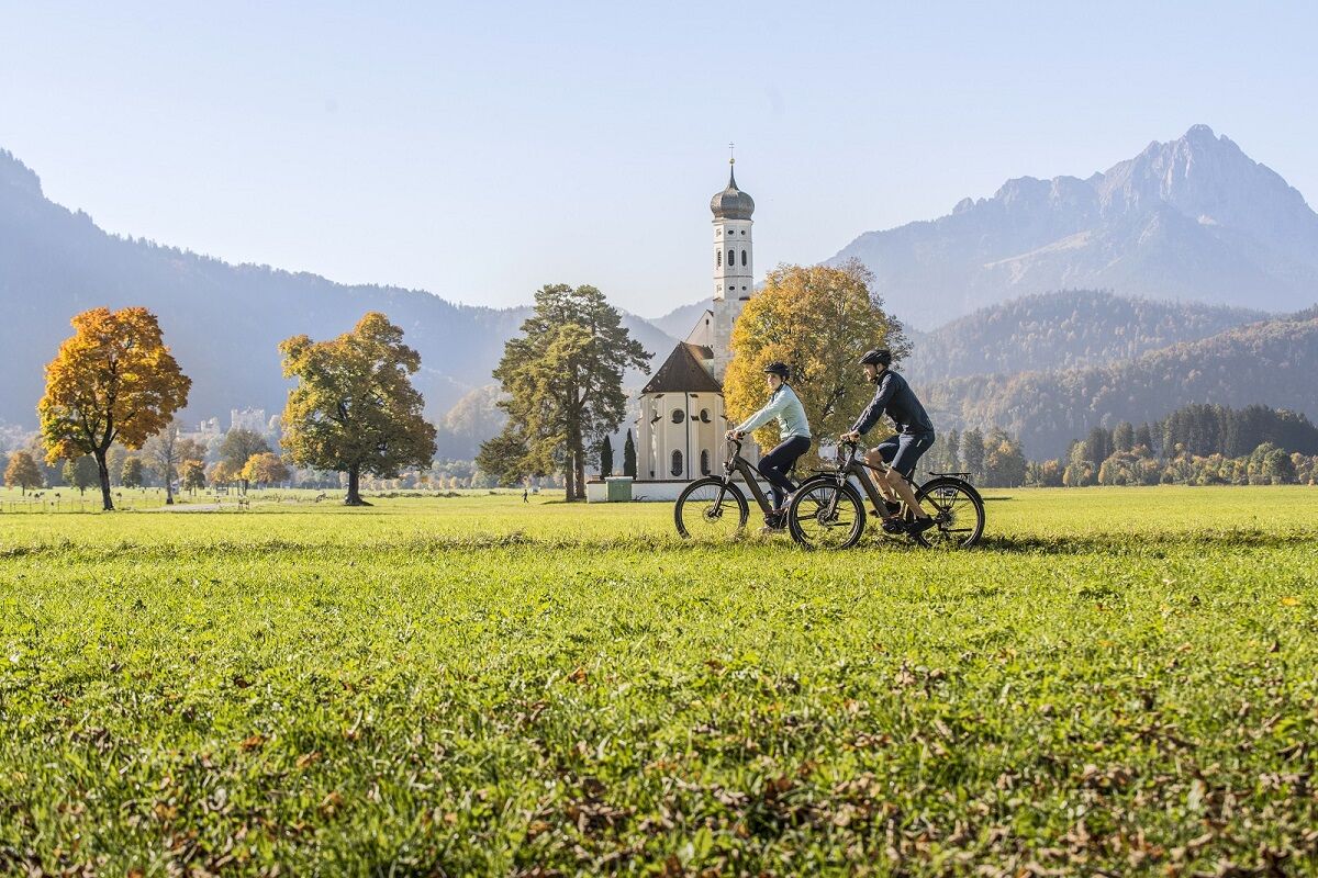
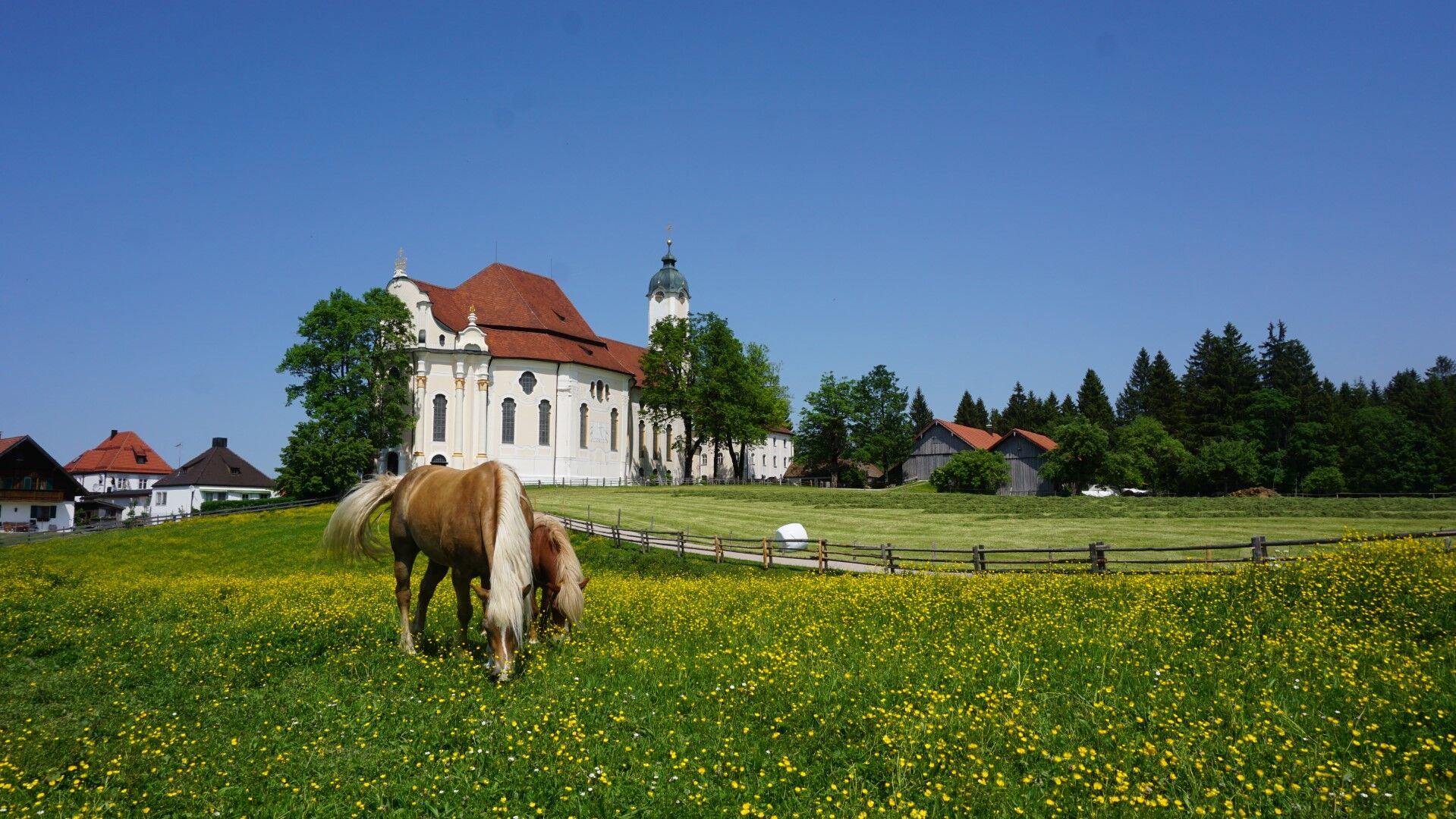
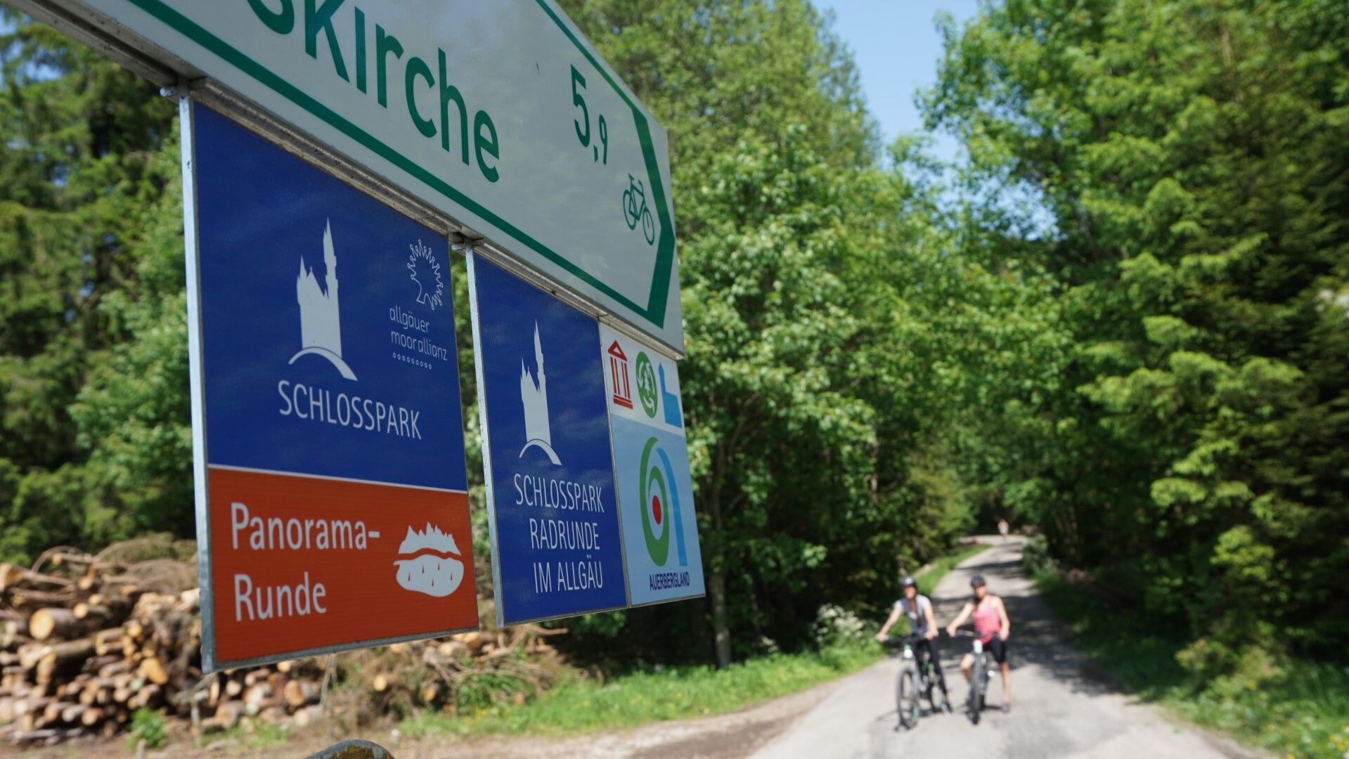
The Schlossparkradrunde in Allgäu is a quality cycle route with a length of around 219 km. The first section leads from Füssen to Lechbruck am See and runs between mountains, castles and lakes.
- Reitti
-
Füssen (808 m)St. Sebastian0,1 kmAlterschrofen1,8 kmNeuschwanstein-Blick1,8 kmWaldmann1,9 kmHohenschwangau3,7 kmSchwangau (796 m)5,9 kmMühlberg8,2 kmRestaurant Bannwaldsee9,5 kmBayerniederhofen (799 m)14,1 kmHafenfeld14,4 kmHalblech15,6 kmTrauchgau (792 m)17,2 kmGasthof Hirsch17,5 kmUnterreithen20,7 kmSt. Michael20,7 kmMarienkapelle21,2 kmOberreithen21,2 kmSchober21,9 kmResle24,8 kmGasthof Schweiger27,0 kmWies27,2 kmWieskapelle27,2 kmLitzau29,6 kmGagras31,2 kmLourdes-Kapelle31,4 kmGrabkapelle der Grafen Dürkheim31,8 kmSteingaden31,9 kmAlpenpanorama33,1 kmGasthaus Drei Mohren34,2 kmSt. Maria Magdalena34,3 kmUrspring34,5 kmLechbruck am See39,8 km
- Paras kausi
-
tammihelmimaalishuhtitoukokesäheinäelosyyslokamarrasjoulu
- Korkein kohta
- 877 m
- Kohde
-
Lechbruck am See
- Korkeusprofiili
-
 © outdooractive.com
- Kirjoittaja
-
Kiertue Schlossparkradrunde im Allgäu - Section 1 käyttää outdooractive.com toimitettu.
GPS Downloads


Yleistä tietoa
Kulttuuri/Historiallinen
Lisää retkiä alueilla