© Allgäu GmbH, Gesellschaft für Standort und Tourismus - Timon Oberheide

© Allgäu GmbH, Gesellschaft für Standort und Tourismus - Timon Oberheide

© Allgäu GmbH, Gesellschaft für Standort und Tourismus - Timon Oberheide

© Allgäu GmbH, Gesellschaft für Standort und Tourismus - Timon Oberheide

© Allgäu GmbH, Gesellschaft für Standort und Tourismus - Timon Oberheide

© Allgäu GmbH, Gesellschaft für Standort und Tourismus - Timon Oberheide
Retkitiedot
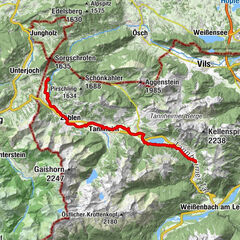
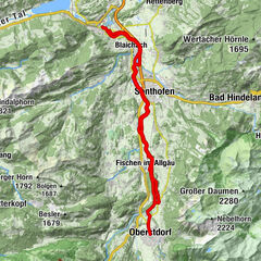
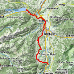
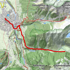
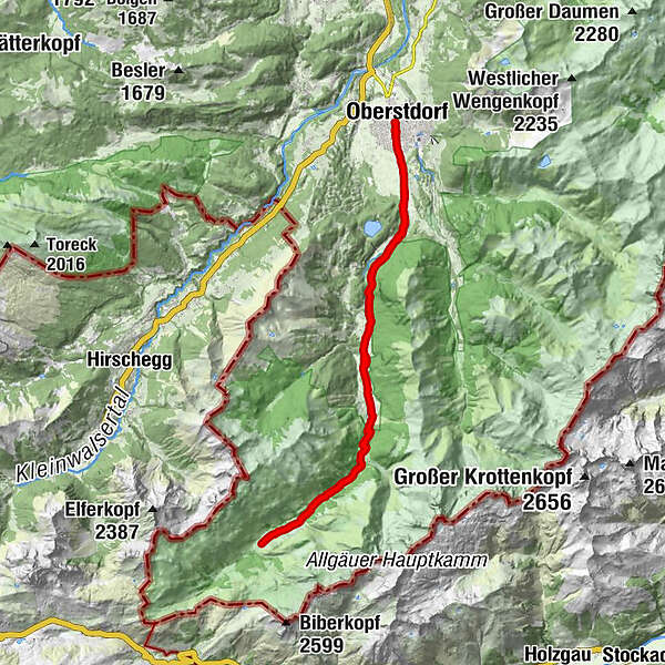
31,92km
807
- 1.228m
404hm
401hm
03:00h
- Lyhyt kuvaus
-
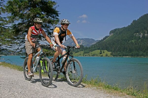
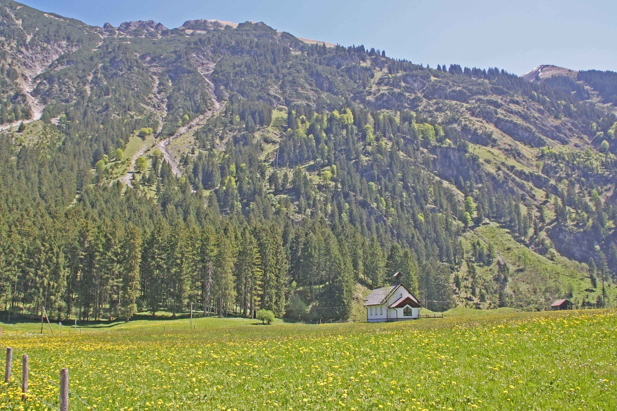
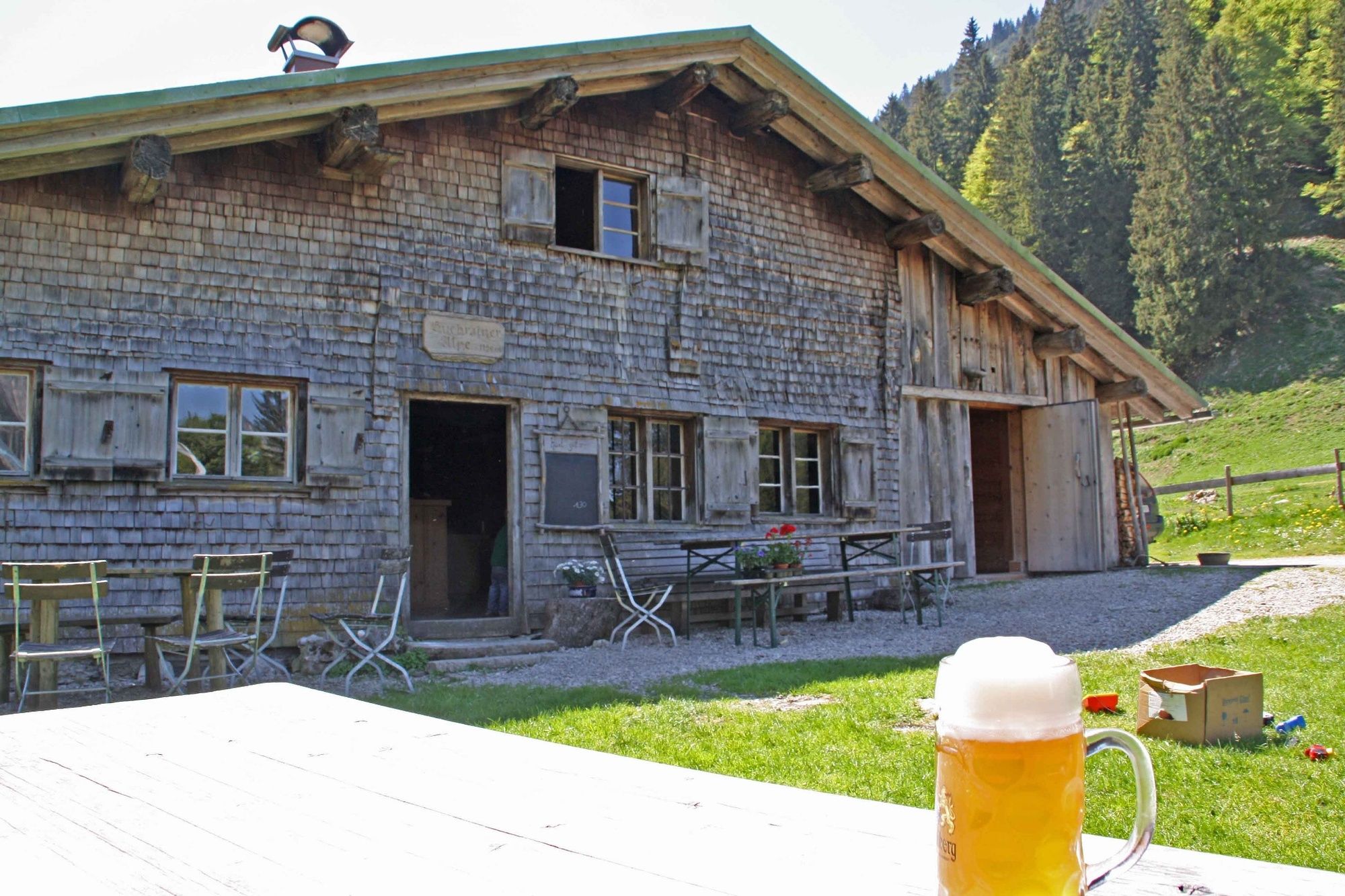
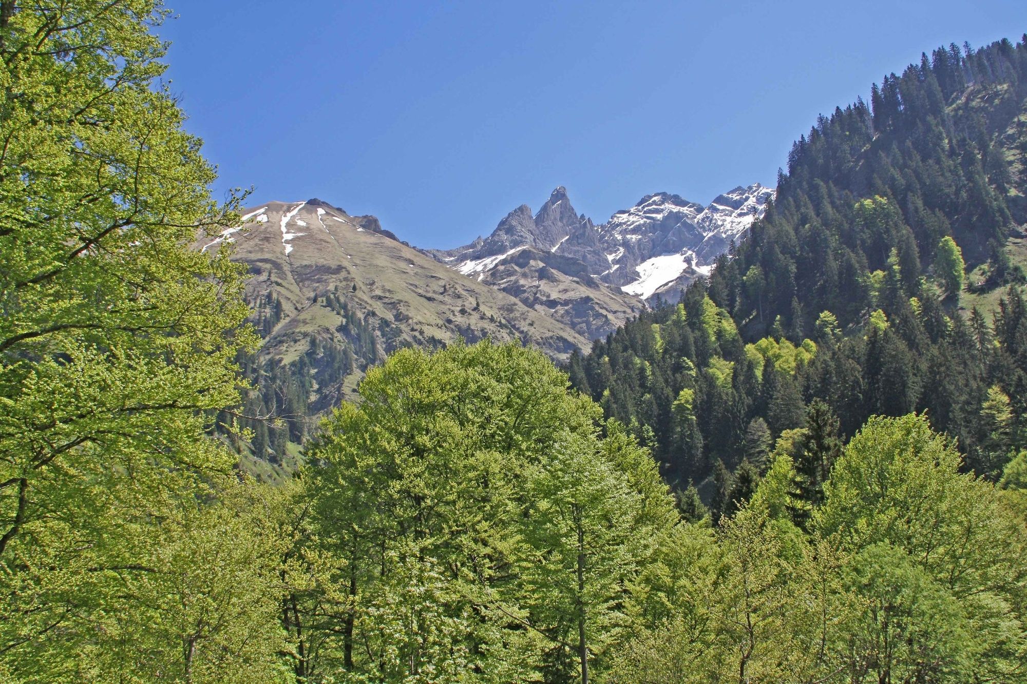
Vom Bahnhof Oberstdorf fahren wir über Birgsau in das Rappenalptal. Verschiedene Einkehrmöglichkeiten in aussichtsreicher Lage bieten stärkende Mahlzeiten für die durchaus anstrengende Tour an.
- Vaikeus
-
tapa
- Arviointi
-
- Reitti
-
Oberstdorf (813 m)0,0 kmSt. Johannes Baptist0,3 kmSeelenkapelle0,3 kmMegèver Platz0,4 kmKapelle Maria Loretto1,6 kmAppachkapelle1,6 kmJosefskapelle1,6 kmKapelle St. Wendel6,0 kmAnatswald8,0 kmBirgsau9,0 kmAlpe Eschbach9,4 kmAlpe Eschbach9,5 kmAlpe Eschbach22,2 kmBirgsau22,6 kmAnatswald23,9 kmKapelle St. Wendel25,6 kmJosefskapelle30,1 kmKapelle Maria Loretto30,1 kmAppachkapelle30,2 kmMegèver Platz31,4 kmSeelenkapelle31,4 kmSt. Johannes Baptist31,4 kmOberstdorf (813 m)31,8 km
- Paras kausi
-
tammihelmimaalishuhtitoukokesäheinäelosyyslokamarrasjoulu
- Korkein kohta
- 1.228 m
- Kohde
-
Schwarze Hütte (Rappenalpe)
- Korkeusprofiili
-
 © outdooractive.com

- Kirjoittaja
-
Kiertue Tour ins Stillach- und Rappenalptal käyttää outdooractive.com toimitettu.
GPS Downloads


Yleistä tietoa
Virvokepysäkki
Lupaava
Lisää retkiä alueilla