Talvi
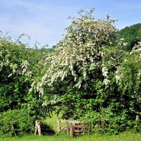
Kesä
Sää
Webbikamerat
Majoitukset
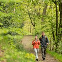
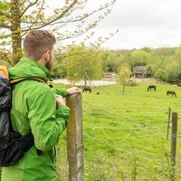
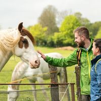
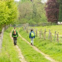
Retket
Hakuhistoria
Hakuehdotukset
Tuloksia ei löytynyt
Etsi
Retket
Etusivu
Kesä Belgium
Retket
Hiking
Alueet
Webbikamerat
Retket
Highlights
Uimajärvet
Urheilutoimittaja
Tapahtumat
Hiihtoalueet
Hiihto
Lumipuistot
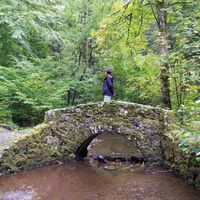
Hiking
Belgium
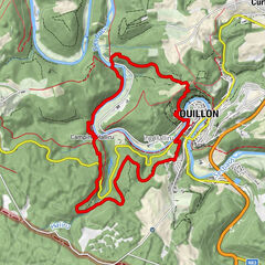
Kartta
näytä
piilota
Suodata matkat
Alue
Retkityyppi
(Kaikki)
Hiking (873)
long-distance walking trail (34)
Thematic route (8)
Pilgrimage (3)
Koko tekstin haku
Kunto
min.
1 helppo
2 kohtuullinen
3 keskivaikea
4 vaikea
5 erittäin vaikea
6 äärimmäinen
maks.
1 helppo
2 kohtuullinen
3 keskivaikea
4 vaikea
5 erittäin vaikea
6 äärimmäinen
Tekniikka
min.
1 helppo
2 kohtuullinen
3 keskivaikea
4 vaikea
5 erittäin vaikea
6 äärimmäinen
maks.
1 helppo
2 kohtuullinen
3 keskivaikea
4 vaikea
5 erittäin vaikea
6 äärimmäinen
Pituus (km)
Korkeusmittari
muut suodattimet
Hae
Palauta
918 Retket.
lajiteltu
Relevanz
Relevanz
längste Distanz
kürzeste Distanz
pisin kesto
lyhin kesto
eniten pystymetrejä
vähiten pystymetrejä
korkea kunto
heikko kunto
huipputeknologia
alhainen teknologia
Nimi A-Z
Nimi Z-A
Das Vorzimmer des Venns
helppo
6,35
km
02:00
h
157
hm
509 - 625
m
Tekniikka
Kunto
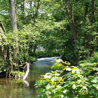
Pleasure tour 2 – Down there flows a river
tapa
9,12
km
02:34
h
197
hm
317 - 507
m
Tekniikka
Kunto
Pleasure tour 9 – Welcome up here
tapa
12,83
km
03:37
h
330
hm
349 - 495
m
Tekniikka
Kunto
Kids on Tour - Experience nature with all your senses
helppo
6,05
km
01:35
h
110
hm
492 - 616
m
Tekniikka
Kunto
Pleasure tour 22 – A walk for the soul
helppo
3,0
7,93
km
02:05
h
86
hm
208 - 278
m
Tekniikka
Kunto
Um den "Roche à l'Appel" – Geologische Wanderung bei Muno
helppo
8,71
km
03:00
h
186
hm
278 - 423
m
Tekniikka
Kunto
Tal der Blumen
tapa
9,83
km
02:30
h
176
hm
181 - 248
m
Tekniikka
Kunto
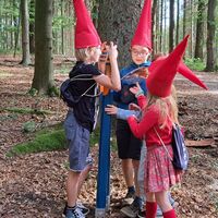
Gnomes path
helppo
3,34
km
00:50
h
21
hm
329 - 353
m
Tekniikka
Kunto
Hoch über der Ourthe – Von La Roche-en-Ardenne nach Maboge
tapa
1,0
13,38
km
04:30
h
358
hm
220 - 417
m
Tekniikka
Kunto
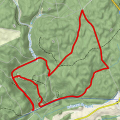
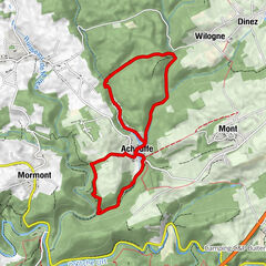
Durchs Tal der Feen – Tour um die Brauerei von Achouffe
helppo
9,14
km
04:00
h
180
hm
324 - 425
m
Tekniikka
Kunto
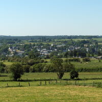
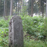
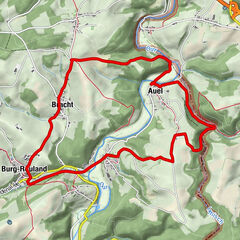
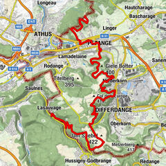
Border routes – From the foot of the Eifel to the Mergelland
tapa
27,18
km
06:46
h
351
hm
189 - 329
m
Tekniikka
Kunto
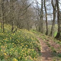
Daffodil walk 8 km
helppo
7,81
km
02:00
h
88
hm
576 - 654
m
Tekniikka
Kunto
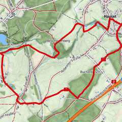
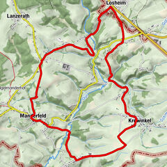
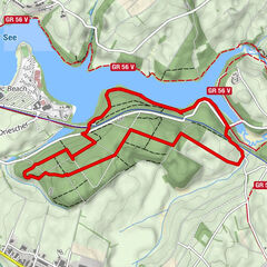
GR56 – Amel / Losheimergraben
tapa
22,22
km
05:45
h
348
hm
435 - 671
m
Tekniikka
Kunto
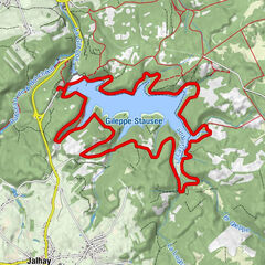
Rund um die Gileppe-Talsperre
helppo
14,96
km
04:15
h
241
hm
298 - 363
m
Tekniikka
Kunto
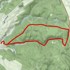
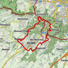
Moresnet: Heiligtumsfahrt
helppo
8,7
km
02:20
h
122
hm
169 - 335
m
Tekniikka
Kunto
Pleasure tour 15 – A quaint Land
tapa
15,04
km
04:00
h
249
hm
481 - 598
m
Tekniikka
Kunto
Pleasure tour 3 – The Bayehon waterfall
tapa
12,61
km
03:23
h
186
hm
499 - 637
m
Tekniikka
Kunto
Kids on Tour - Fun in the forest and water
helppo
5,67
km
01:30
h
44
hm
546 - 588
m
Tekniikka
Kunto
“Border routes - On the trail of a political artefact”
helppo
18,35
km
04:15
h
285
hm
162 - 333
m
Tekniikka
Kunto
European long-distance path GR 570
helppo
25,55
km
07:20
h
433
hm
268 - 428
m
Tekniikka
Kunto
Sivut:
1
2
3
4
5
6
7
8
seuraava
Matkat tyypeittäin
Hiking
Bike
Winter
Motorsport
Water
Other
Running
Hiking
long-distance walking trail
Thematic route
Pilgrimage
Maat
Itävalta
Sveitsi
Saksa
Italia
Slovenia
Ranska
Alankomaat
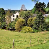
Belgium
Tšekki
Slovakia
Espanja
Kroatia
Bosnia ja Hertsegovina
Luxemburg
Liechtenstein
Andorra
Wallonia
Flemish Region
Brussels-Capital Region
Suosittuja retkiä alueella
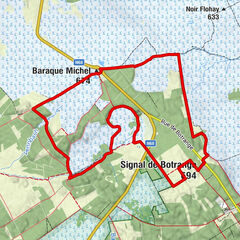
Baraque Michel - Signal de Botrange - Butte Baltia - Le Signal de B...
tapa
13,8
km |
191
hm |
03:23
h
Pleasure tour 3 – The Bayehon waterfall
tapa
12,61
km |
186
hm |
03:23
h
Stage 1: Venntrilogie - Border triangle to Eynatten
tapa
23,4
km |
233
hm |
06:15
h
En passant par le pont suspendu de l'Épine
tapa
11,97
km |
205
hm |
04:35
h
Arpajaiset
Produkt-Paket für die ganze Familie
Primavera XXL-Gewinnspiel
Merkintöjä ei löytynyt.
Haku ei ole tällä hetkellä käytettävissä.
Tarkenna hakua.
Paikalliset hakutulokset
(<= 25km)
Lisää hakutuloksia
(> 25km)
%count% Hakutulokset
%name%
%type%
%elevation%
%population%
%lpButton%