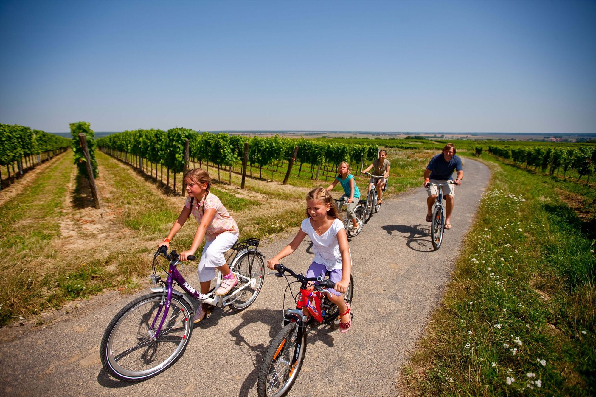
© Mittelburgenland-Rosalia - Tom Lamm


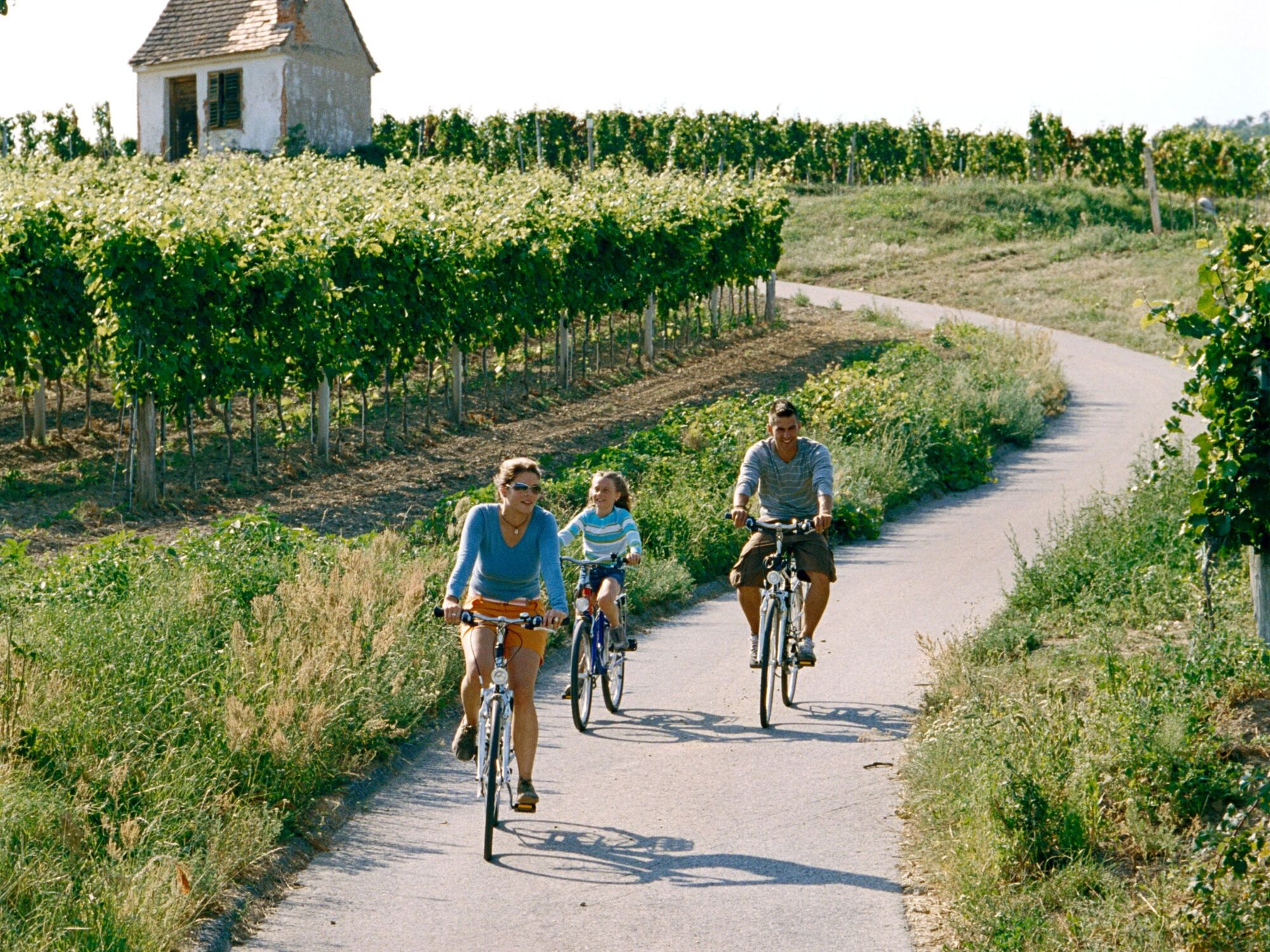
© Mittelburgenland-Rosalia - Annemarie Schreiner

- Lyhyt kuvaus
-
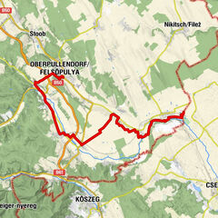
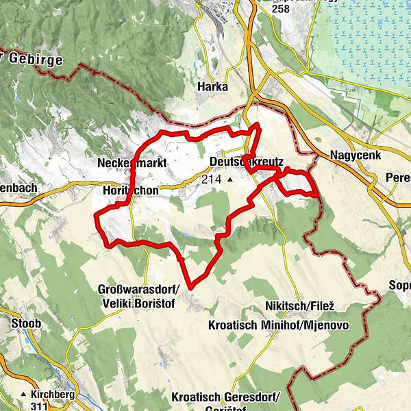
A beautiful circuit througt the well-kept vineyards around Deutschreutz, Raiding, Horitschon and Neckenmarkt.
- Vaikeus
-
helppo
- Arviointi
-
- Reitti
-
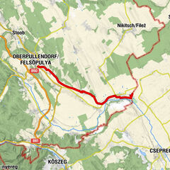
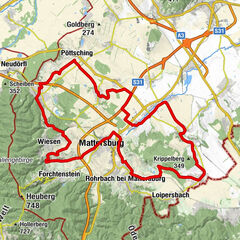
Christihimmelfahrt-Kapelle1,0 kmWeinbergkapelle4,9 kmKleinwarasdorf13,8 kmRaiding20,2 kmBuschenschank Schekolin20,2 kmHoritschon23,9 kmGasthaus Lazarus23,9 kmGasthaus Trummer24,0 kmNeckenmarkt25,3 kmHl. Johannesquelle25,3 kmGasthof zur Traube25,4 kmFriedhofskapelle25,7 kmJohannes-Nepomuk-Kapelle35,8 kmDeutschkreutz35,9 kmPfarrkirche Deutschkreutz36,0 kmTristan im Schaflerhof37,8 km
- Paras kausi
-
tammihelmimaalishuhtitoukokesäheinäelosyyslokamarrasjoulu
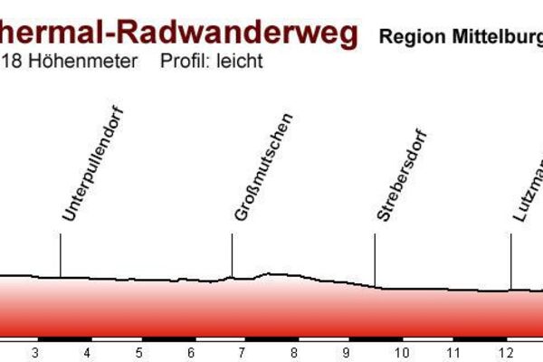
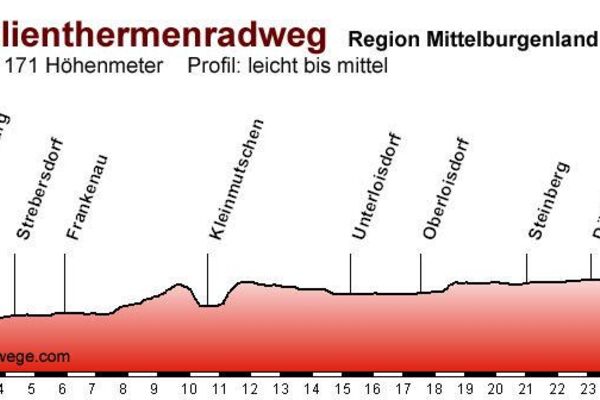
- Korkein kohta
- 295 m
- Kohde
-
Deutschkreutz
- Korkeusprofiili
-


- Kirjoittaja
-
Kiertue B 40 red wine cycle path käyttää outdooractive.com toimitettu.
GPS Downloads


Yleistä tietoa
Virvokepysäkki
Lisää retkiä alueilla