Retkitiedot
100,59km
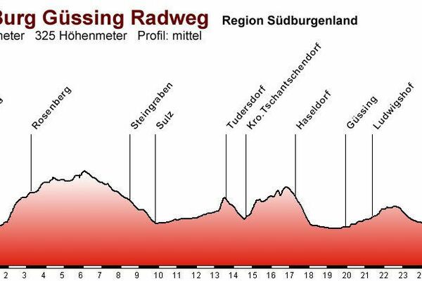
198
- 355m
730hm
730hm
04:17h
- Lyhyt kuvaus
-
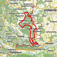
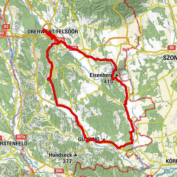
Rundkurs im Südburgenland
- Vaikeus
-
tapa
- Arviointi
-
- Lähtöpiste
-
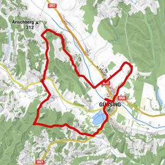
Olobendorf
- Reitti
-
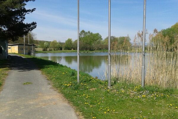
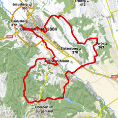
Olbendorf0,4 kmEisenberg1,9 kmHochberg3,2 kmHöhried4,3 kmNeubürgersiedlung11,2 kmOberwart14,8 kmPizza Bella34,5 kmGroßpetersdorf34,6 kmWelgersdorf37,1 kmHannersdorf38,7 kmPfarrkirche Maria Geburt39,5 kmBurg42,4 kmKainz Gasthaus48,7 kmEisenberg an der Pinka48,8 kmSt. Martin51,4 kmKirche Höll53,7 kmHöll53,8 kmEdlitz im Burgenland55,2 kmKirche Edlitz55,3 kmJosephs-Kapelle57,3 kmWinten57,4 kmHeilige-Dreifaltigkeit59,1 kmKulm im Burgenland59,1 kmFilialkirche hl. Anna61,8 kmGaas61,8 kmGaaser Bergen63,4 kmMaria Weinberg64,0 kmPfarrkirche hl. Antonius von Padua70,0 kmStrem70,0 kmGasthaus Kedl73,2 kmUrbersdorf (218 m)73,8 kmFilialkirche zur seligsten Jungfrau Maria73,8 kmGüssing (229 m)79,9 kmKlosterkirche Mariä Heimsuchung80,0 kmTobaj84,6 kmDeutsch Tschantschendorf87,6 kmGasthof Walits - Guttmann87,6 kmPfarrkirche Mariae Geburt87,8 kmSankt Michael im Burgenland89,8 kmRauchwart im Burgenland93,0 kmMarx’sche Häuser96,9 kmOlbendorf99,5 km
- Paras kausi
-
tammihelmimaalishuhtitoukokesäheinäelosyyslokamarrasjoulu
- Korkein kohta
- Oberdorf (355 m)
- Kohde
-
Güssing
- Lähde
- Martin Scholz
GPS Downloads


Ajoreitit
Asfaltti
Sora
Metsä
Vuoripolut
Singletrails
Trial
Liikenne
Lisää retkiä alueilla
-
Thermen- & Vulkanland
344
-
Südburgenland
127
-
Güttenbach
31