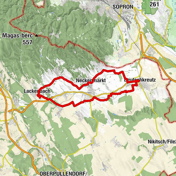
Retkitiedot
32,16km
181
- 334m
141hm
132hm
02:32h
- Vaikeus
-
tapa
- Arviointi
-
- Lähtöpiste
-
Bahnhof Deutschkreutz
- Reitti
-
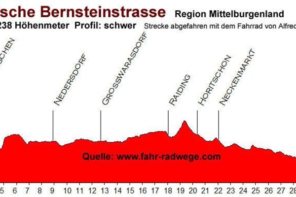
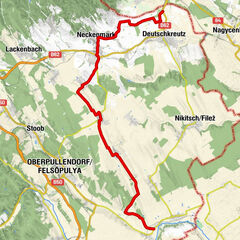
Deutschkreutz0,0 kmDeutschkreutz0,3 kmSiedlung Hauswiesen1,3 kmFriedhofskapelle7,6 kmNeckenmarkt7,8 kmRitzing12,5 kmPfarrkirche hll. Petrus u. Paulus15,8 kmCafe-Restaurant Waya16,0 kmLackenbach16,0 kmGasthof zum Schilling16,9 kmMariensäule17,0 kmHoritschon24,0 kmUnterpetersdorf27,4 kmPizzaria Leonardo27,6 kmPfarrkirche hl. Rosalia27,6 kmDeutschkreutz31,5 kmDeutschkreutz31,8 km
- Paras kausi
-
tammihelmimaalishuhtitoukokesäheinäelosyyslokamarrasjoulu
- Korkein kohta
- 334 m
- Kohde
-
Bahnhof Deutschkreutz