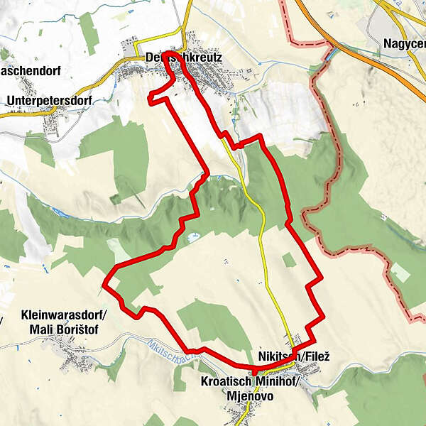
Retkitiedot
25,46km
182
- 295m
187hm
180hm
02:12h
- Vaikeus
-
tapa
- Arviointi
-
- Lähtöpiste
-
Bahnhof Deutschkreutz
- Reitti
-
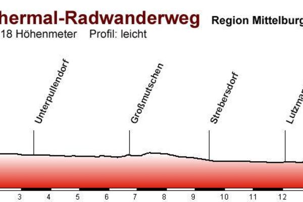
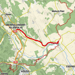
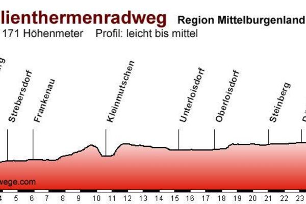
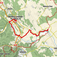
Deutschkreutz0,0 kmJohannes-Nepomuk-Kapelle0,3 kmPfarrkirche Deutschkreutz0,5 kmDeutschkreutz0,6 kmNikitsch10,1 kmDeutschkreutz24,5 kmDeutschkreutz25,1 km
- Paras kausi
-
tammihelmimaalishuhtitoukokesäheinäelosyyslokamarrasjoulu
- Korkein kohta
- 295 m
- Kohde
-
Bahnhof Deutschkreutz