Retkitiedot
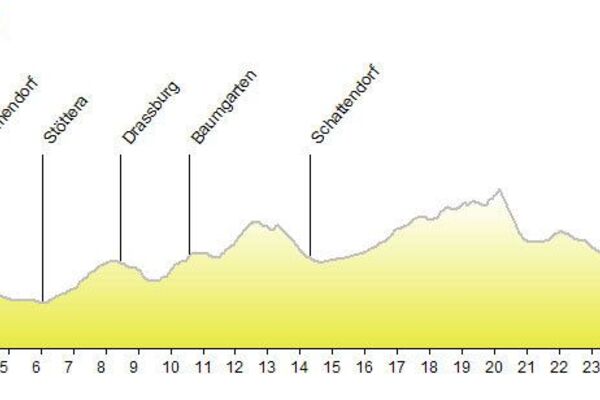
26,56km
181
- 389m
287hm
287hm
02:09h
- Vaikeus
-
helppo
- Arviointi
-
- Lähtöpiste
-
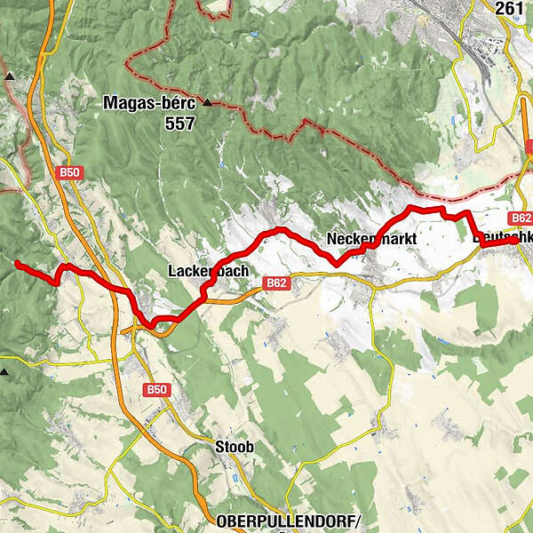
Bahnhof Deutschkreutz
- Reitti
-
Deutschkreutz0,0 kmDeutschkreutz0,2 kmSiedlung Hauswiesen1,3 kmFriedhofskapelle7,6 kmNeckenmarkt7,8 kmRitzing12,5 kmPfarrkirche hll. Petrus u. Paulus15,8 kmCafe-Restaurant Waya15,9 kmGasthaus La Familia16,0 kmLackenbach16,1 kmElisabethgartl18,2 kmEvangelische Pfarrkirche A.B.19,7 kmWeppersdorf20,1 kmDorfgasthof Berlakovich20,3 kmGasthaus Fuchs20,6 kmPfarrkirche Hl. Dreifaltigkeit20,6 kmZum Dorfwirt'n23,6 kmKobersdorf23,7 kmPfarrkirche hl. Nikolaus23,8 kmWaldmühle26,1 km
- Paras kausi
-
tammihelmimaalishuhtitoukokesäheinäelosyyslokamarrasjoulu
- Korkein kohta
- 389 m
- Kohde
-
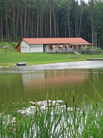
Naturpark Badesee Kobersdorf