© Bad Tatzmannsdorf Tourismus - Regionalmarketing Bad Tatzmannsdorf/V. Baum


© Bad Tatzmannsdorf Tourismus - Regionalmarketing Bad Tatzmannsdorf/V. Baum

© Bad Tatzmannsdorf Tourismus - Regionalmarketing Bad Tatzmannsdorf/V. Baum

© Bad Tatzmannsdorf Tourismus - Regionalmarketing Bad Tatzmannsdorf/V. Baum
- Lyhyt kuvaus
-
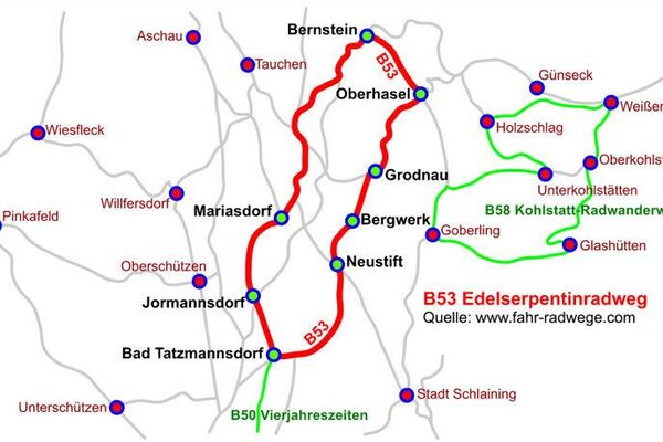
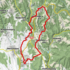
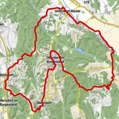
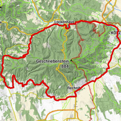
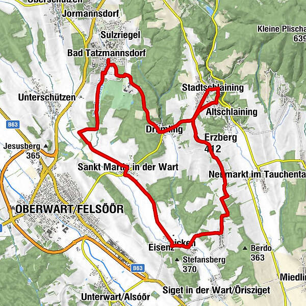
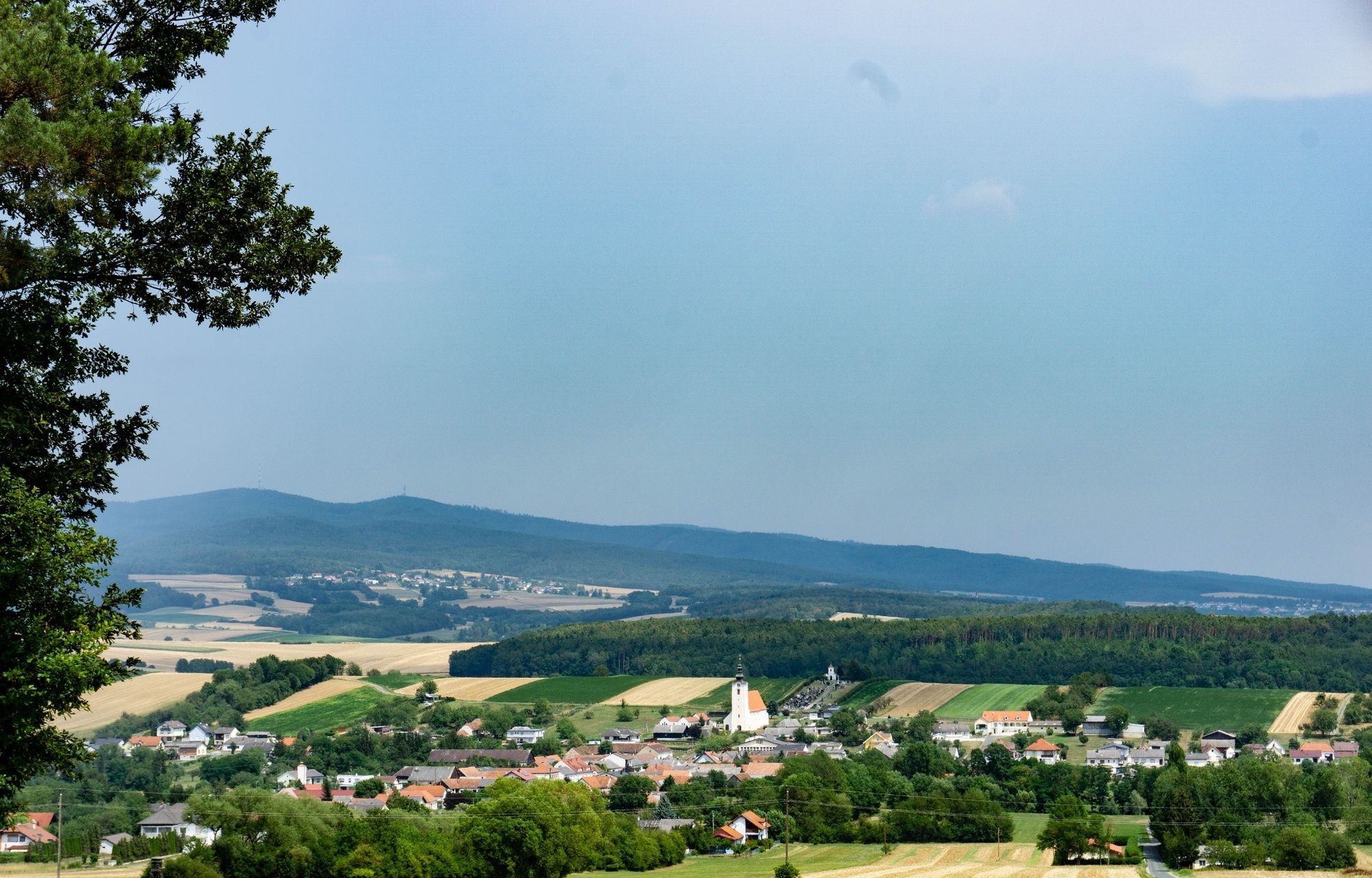
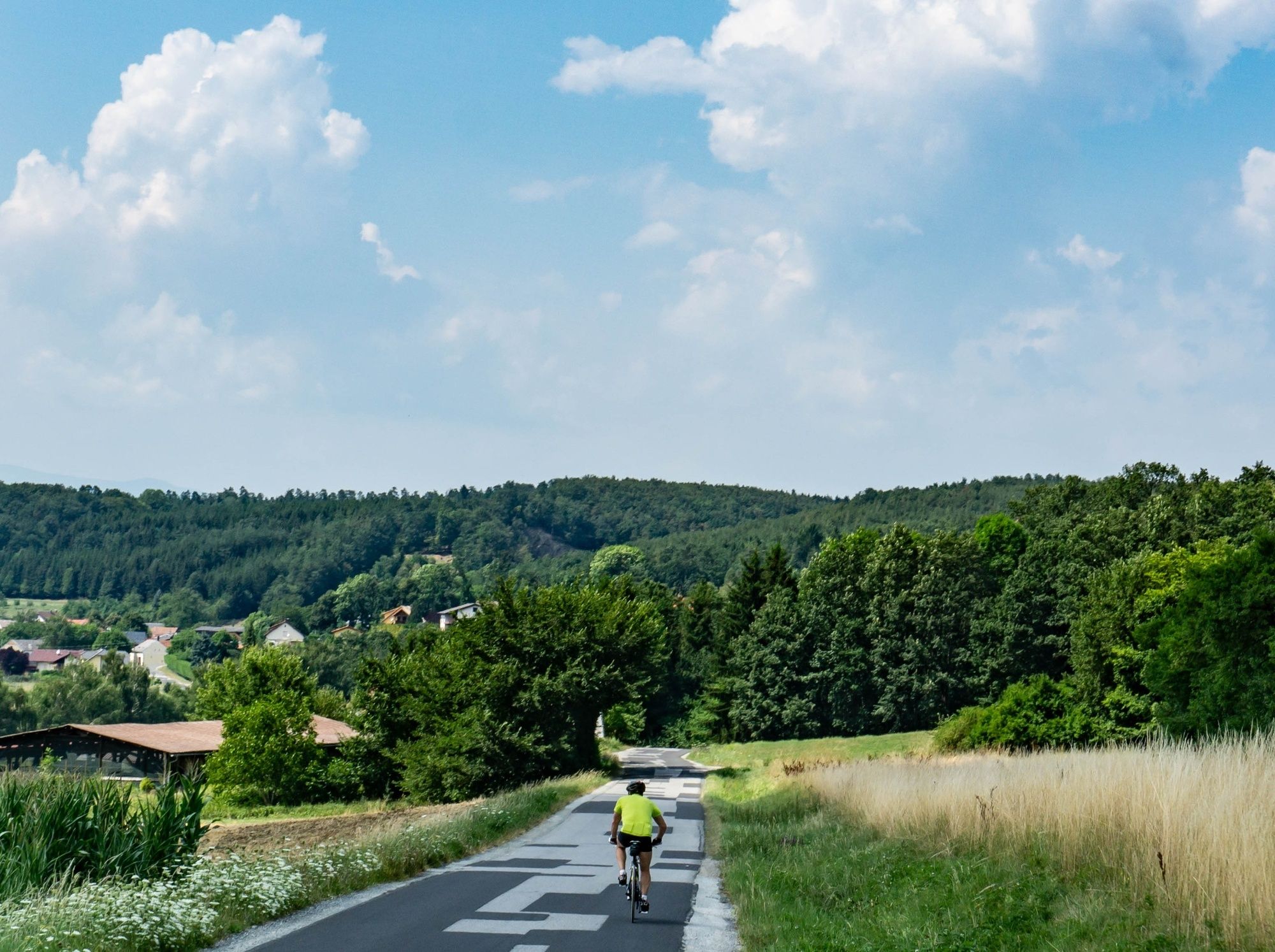
Von Bad Tatzmannsdorf nach Stadtschlaining mit wunderschönen Aus- und Weitblicken!
- Vaikeus
-
helppo
- Arviointi
-
- Reitti
-
Bad TatzmannsdorfSankt Martin in der Wart5,3 kmPfarrkirche hl. Martin5,3 kmEisenzicken8,4 kmFilialkirche hll. Fabian und Sebastian8,6 kmSpitzzicken10,3 kmGieberling13,0 kmErzberg (412 m)14,5 kmMike's Cafe Pub16,8 kmGasthaus Leitner16,8 kmStadtschlaining16,8 kmEvang. Pfarrkirche A.B.17,1 kmGasthaus Bayer19,2 kmDrumling19,4 kmBad Tatzmannsdorf23,1 km
- Paras kausi
-
tammihelmimaalishuhtitoukokesäheinäelosyyslokamarrasjoulu
- Korkein kohta
- 418 m
- Kohde
-
7431 Bad Tatzmannsdorf, Gästeinformation
- Korkeusprofiili
-


- Kirjoittaja
-
Kiertue B50 Vier-Jahreszeiten-Radweg käyttää outdooractive.com toimitettu.
GPS Downloads


Yleistä tietoa
Virvokepysäkki
Kulttuuri/Historiallinen
Lisää retkiä alueilla