Talvi
Kesä
Sää
Webbikamerat
Majoitukset
Retket
Hakuhistoria
Hakuehdotukset
Tuloksia ei löytynyt
Etsi
Retket
Etusivu
Kesä Bosnien und Herzegowina
Federation of Bosnia and Herzegovina
Retket
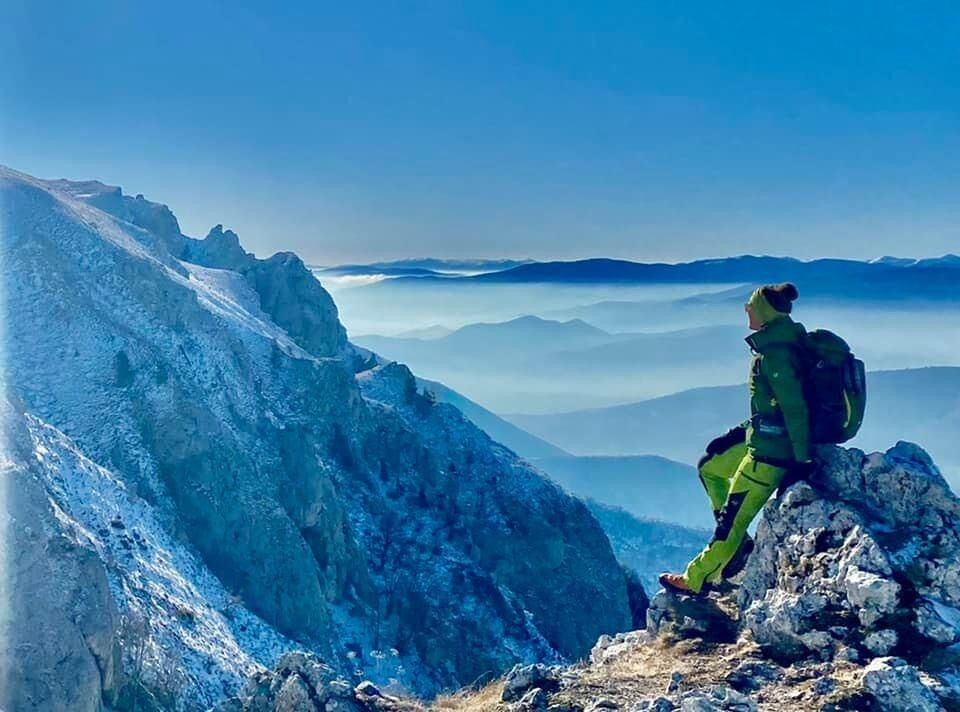
Galica - Devecani - Paljenik 1936 hm Bosnien und Herzegowina
Alueet
Webbikamerat
Retket
Highlights
Uimajärvet
Urheilutoimittaja
Tapahtumat
Hiihtoalueet
Hiihto
Lumipuistot
Galica - Devecani - Paljenik 1936 hm Bosnien und Herzegowina
Kirjanmerkki
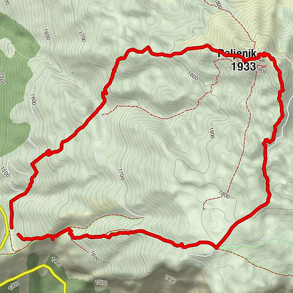
Kartta
näytä
piilota
Tulosta
Retkitiedot
8,66
km
1.466 - 1.937
m
Distanz
498
hm
505
hm
Nousu
02:51
h
Kesto
Jasmina Tabakovic 1
laadittu am 02.09.2021
152
Puhelut
Vaikeus
tapa
Arviointi
Tekniikka
Kunto
Maisema
Elämys
Reitti
Planinarski dom "Jusuf Pečenković"
alpine hut
1,8 km
Devečani
locality
1,9 km
Paljenik
(1.933 m)
peak
4,7 km
Korkein kohta
1.937 m
Kirjoita arvostelu
Yleinen luokitus
5
0
%
4
0
%
3
0
%
2
0
%
1
0
%
Arviot
(0)
0 Kommentit
Kirjoita arvostelu
Virhe
On tapahtunut virhe. Yritä uudelleen.
Kiitos arvostelusta
Luokitus poistettiin
Kiertueen raportti
GPS Downloads
GPX
GPS Exchange Format (XML)
KML
Google Earth, Google Maps
QR-latauskoodit matkapuhelimiin
Galica - Devecani - Paljenik 1936 hm Bosnien und Herzegowina
QR-koodit - Tour lataa matkapuhelimiin
GPX
KML
Merkintöjä ei löytynyt.
Haku ei ole tällä hetkellä käytettävissä.
Tarkenna hakua.
Paikalliset hakutulokset
(<= 25km)
Lisää hakutuloksia
(> 25km)
%count% Hakutulokset
%name%
%type%
%elevation%
%population%
%lpButton%