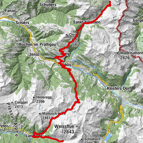
Stage 2, Hüttentour Mittelbünden; Sapün – St. Antönien

Mountainbike

© Graubünden Ferien - Alex Buschor

© Graubünden Ferien - Alex Buschor

© Graubünden Ferien - Alex Buschor

© Graubünden Ferien - Alex Buschor
- Lyhyt kuvaus
-
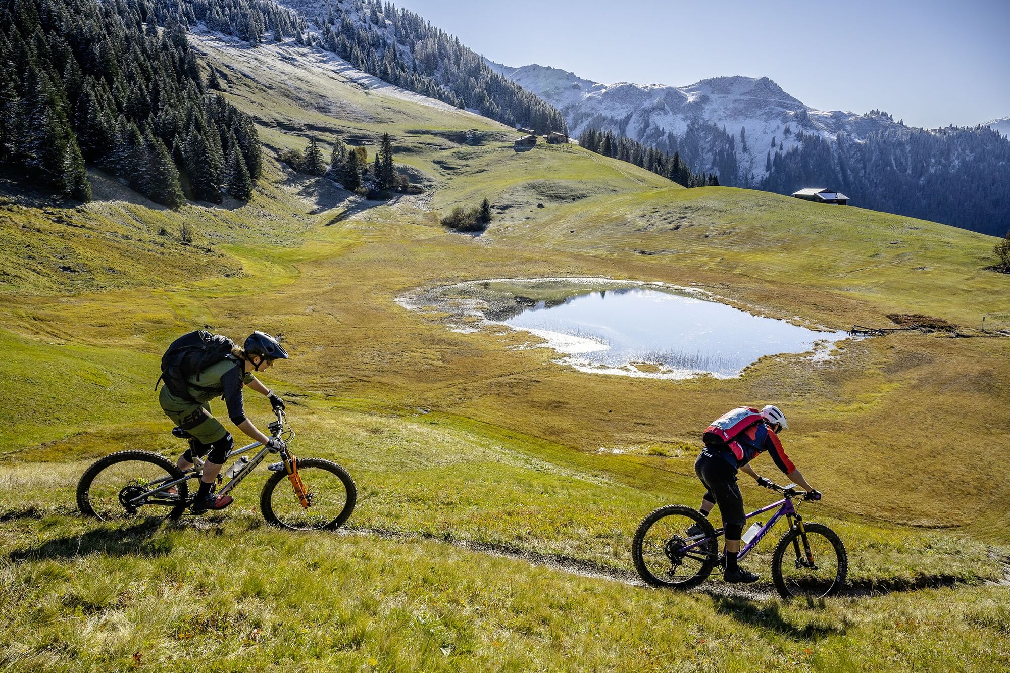
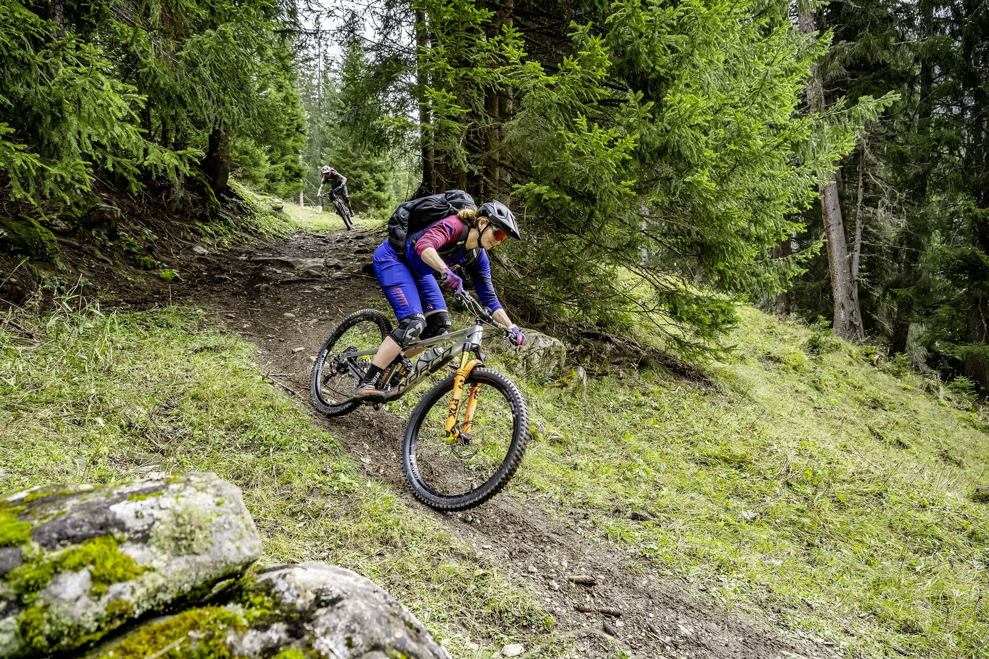
Mittelbünden (Central Grisons) is considered the unknown beauty of the Grisons. Many know the Schanfigg and the Prättigau Valley from passing through, but here lie some of the mountainbike gems of Graubünden. On the three-day Hüttentour through the alpine mountain world of Central Grisons, two of the most extraordinary mountain huts are approached.
- Vaikeus
-
tapa
- Arviointi
-
- Reitti
-
Berggasthaus Heimeli0,0 kmJatz (1.831 m)0,0 kmChüpfen0,2 kmSchmitten (1.730 m)0,9 kmDörfji (1.725 m)1,1 kmEgga1,9 kmReformierte Kirche4,4 kmLangwies (1.373 m)4,5 kmStrassberg (1.919 m)10,3 kmBim Neue Hus10,7 kmReckholdern (1.960 m)11,8 kmBarga (1.994 m)12,7 kmObersäss (2.054 m)14,9 kmFideriser Duranna16,4 kmUntersäss (1.869 m)16,6 kmHirschen24,4 kmKüblis (816 m)24,5 kmRestaurant Bahnhöfli24,5 kmDalvazza25,1 kmLuzein26,7 kmReformierte Kirche Pany29,8 kmDon Antonio29,8 kmPany (1.250 m)29,8 kmGüggelstein30,6 kmChrüzhofbeiz31,3 kmSankt Antönien (1.459 m)38,0 kmHotel Restaurant Rhätia38,0 kmReformierte Kirche St. Antönien38,2 kmPlatz (1.420 m)38,2 kmHotel-Restaurant Madrisajoch38,2 kmMarschall38,3 kmMeierhof38,6 kmLitzirüti39,3 kmPartnun43,3 kmAlpenrösli43,7 km
- Paras kausi
-
tammihelmimaalishuhtitoukokesäheinäelosyyslokamarrasjoulu
- Korkein kohta
- 2.122 m
- Kohde
-
St. Antönien
- Korkeusprofiili
-
 © outdooractive.com


-

-
KirjoittajaKiertue Stage 2, Hüttentour Mittelbünden; Sapün – St. Antönien käyttää outdooractive.com toimitettu.
GPS Downloads


Yleistä tietoa
Virvokepysäkki
Lupaava