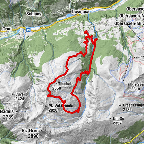
Gratwanderung Vorderalp - Piz Titschal - Blausee - Friggahüs


© Region Surselva Tourismus

© Region Surselva Tourismus

© Region Surselva Tourismus
- Lyhyt kuvaus
-
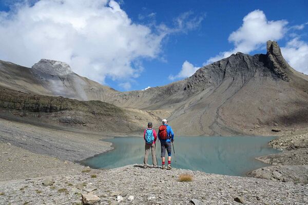
Hier erwartet Sie eine richtige Bergtour mit tollem Gipfelerlebnis. Sie wandern durch saftige Bergwiesen und erreichen das karge Bergland. Hier gibt es urchige Alphütten, einen idyllischen Bergsee und ein prächtiges Gipfelpanorama zu bestaunen.
- Vaikeus
-
vaikea
- Arviointi
-
- Reitti
-
Friggahüs0,0 kmSt. Martin (1.340 m)0,1 kmRiti1,1 kmPiz Titschal (2.550 m)15,5 kmÜsser Wasma21,5 kmSt. Martin (1.340 m)23,2 kmFriggahüs23,4 km
- Paras kausi
-
tammihelmimaalishuhtitoukokesäheinäelosyyslokamarrasjoulu
- Korkein kohta
- 2.595 m
- Kohde
-
Obersaxen, Friggahüs
- Korkeusprofiili
-
 © outdooractive.com


- Kirjoittaja
-
Kiertue Gratwanderung Vorderalp - Piz Titschal - Blausee - Friggahüs käyttää outdooractive.com toimitettu.
GPS Downloads


Yleistä tietoa
Lupaava
Lisää retkiä alueilla
-
Glarnerland
1968
-
Brigels Waltensburg Andiast
661
-
St. Martin
147