From the top end of the cable railway of Fanas to Schuders.


© Prättigau Tourismus - Daniela Göpfert

- Lyhyt kuvaus
-
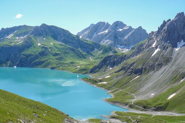
A marvellous hiking tour from Fanas to the tiny mountain village Schuders. The cable railway helps you to mange the gradient and so there will be more time to be amazed at the scenery and to enjoy the tour.
- Vaikeus
-
tapa
- Arviointi
-
- Reitti
-
Alpina0,0 kmBerggasthaus Sassauna0,0 kmFanas (907 m)0,2 kmEggli (1.700 m)2,6 kmHuoba3,5 kmFadurer Fürrgli (2.186 m)9,6 kmSchuderser Maiensäss14,1 kmSchuders17,1 kmBerggasthof Alte Post17,3 km
- Paras kausi
-
tammihelmimaalishuhtitoukokesäheinäelosyyslokamarrasjoulu
- Korkein kohta
- 2.215 m
- Kohde
-
Destination Schuders
- Korkeusprofiili
-
 © outdooractive.com

-

-
KirjoittajaKiertue From the top end of the cable railway of Fanas to Schuders. käyttää outdooractive.com toimitettu.