© Lahntal Tourismus Verband e. V. - ZZ-Katja Bornemann

© Lahntal Tourismus Verband e. V. - ZZ-Katja Bornemann
© Lahntal Tourismus Verband e. V. - ZZ-Katja Bornemann

© Lahntal Tourismus Verband e. V. - ZZ-Katja Bornemann

© Lahntal Tourismus Verband e. V. - ZZ-Katja Bornemann

© Lahntal Tourismus Verband e. V. - ZZ-Katja Bornemann

- Lyhyt kuvaus
-
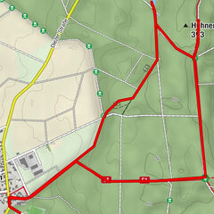
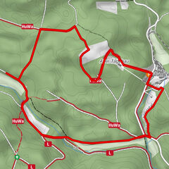
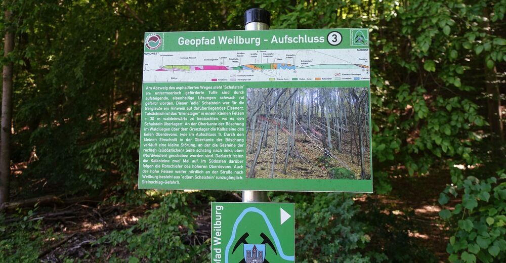
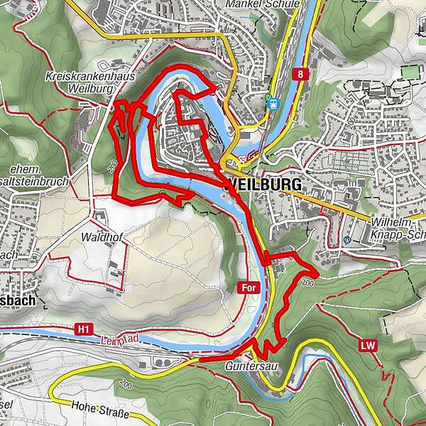
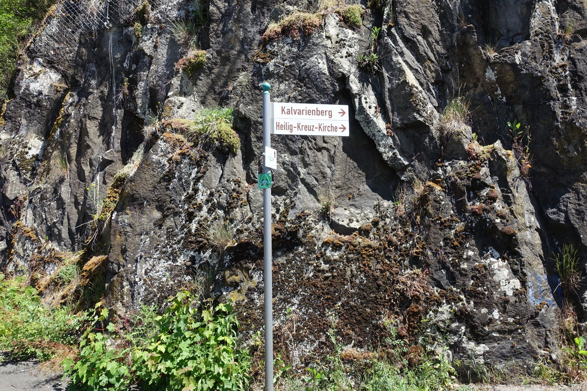
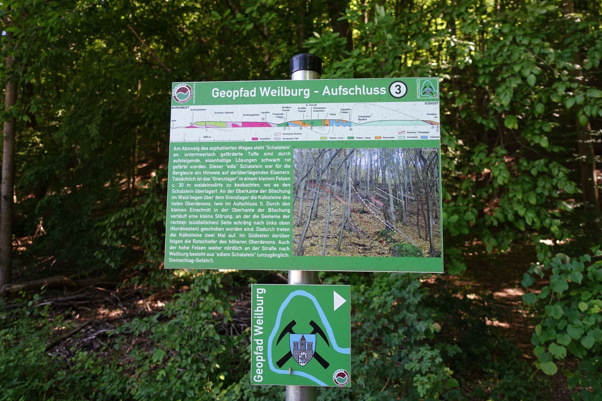
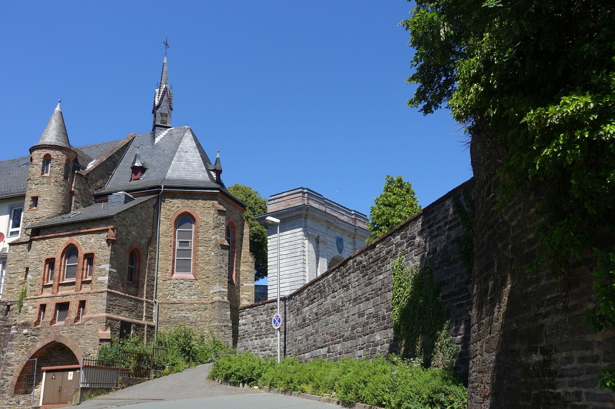
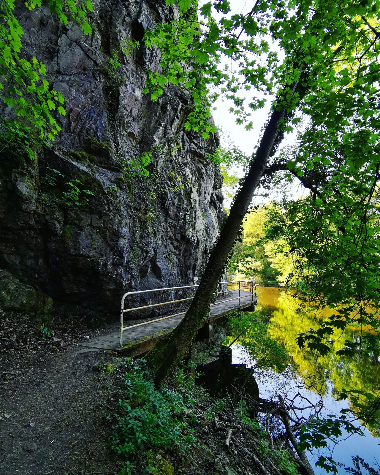
Weilburg ist eine „steinreiche“ Stadt! Der beliebte "Geopfad Weilburg" erstreckt sich über das gesamte Stadtgebiet von Weilburg, inmitten wunderschöner Natur entlang den Ufern der Lahn. Entlang des Weilburger Geopfads informieren 13 Schilder über geologische und geschichtliche Aspekte der Stadt Weilburg.
- Vaikeus
-
tapa
- Arviointi
-
- Reitti
-
Lahnblick0,8 kmWeilburg2,1 kmHeilig-Grab-Kapelle2,3 kmSchlosskirche2,6 kmTempelchen4,9 kmKanapee5,9 km
- Paras kausi
-
tammihelmimaalishuhtitoukokesäheinäelosyyslokamarrasjoulu
- Korkein kohta
- 187 m
- Kohde
-
Tafel 13
- Korkeusprofiili
-
 © outdooractive.com


-

-
KirjoittajaKiertue Geopfad Weilburg käyttää outdooractive.com toimitettu.
GPS Downloads


Yleistä tietoa
Virvokepysäkki
Lupaava
Lisää retkiä alueilla
-
Westerwald / Hessen
714
-
Weilburg
43