- Lyhyt kuvaus
-
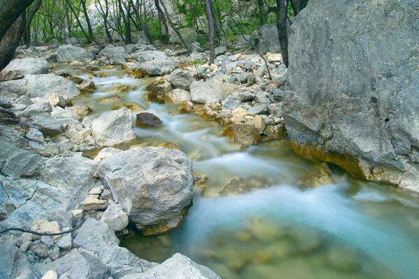
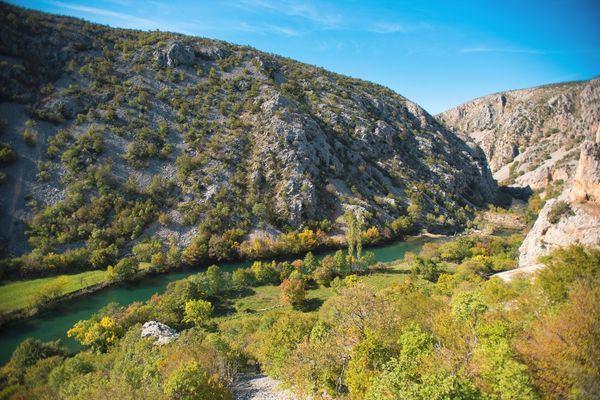
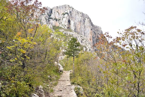
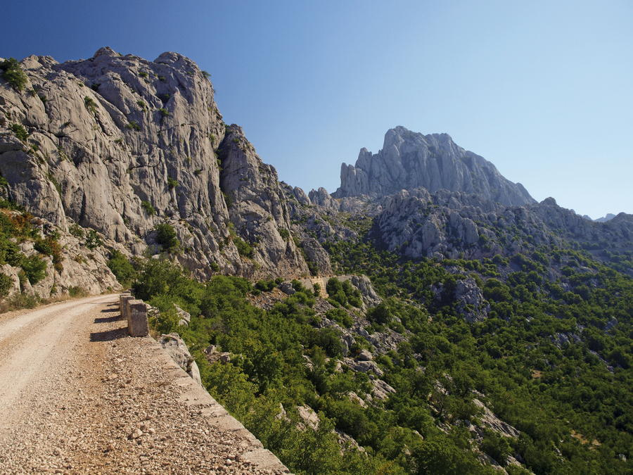
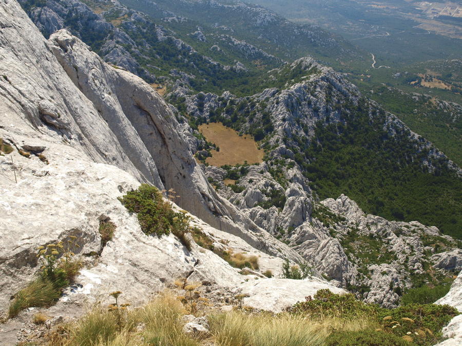
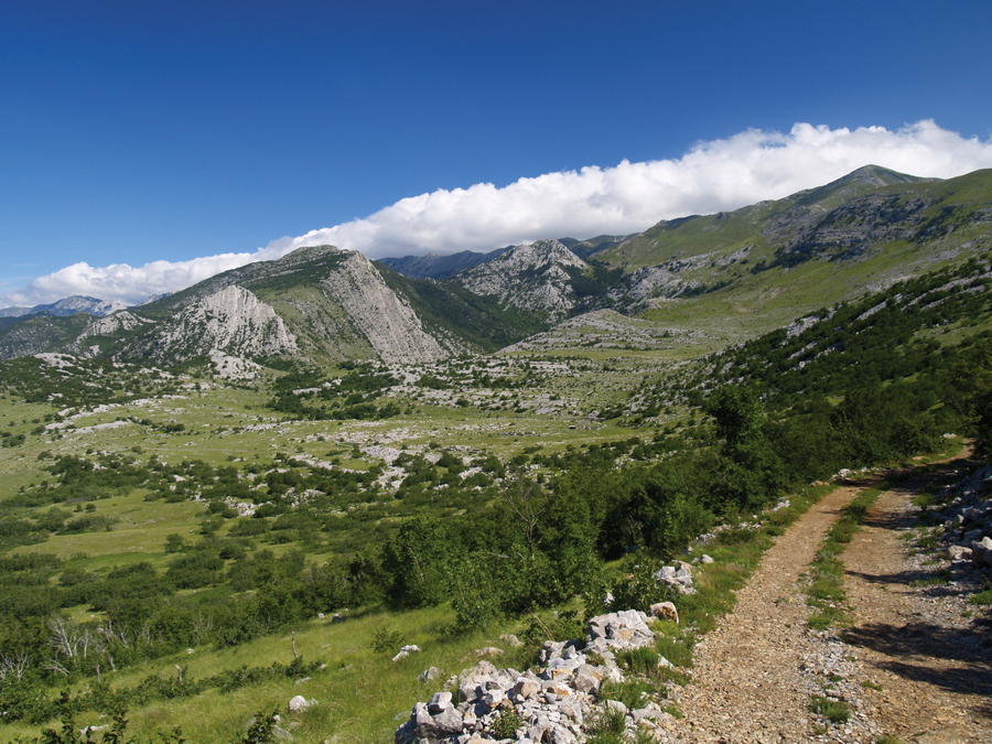
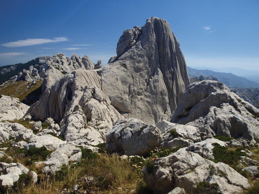
The southernmost part of Velebit, from Mali Halan to the Zrmanja River, extends for 40 kilometers in northwest to southeast direction. Given the fact that the main ridge gradually takes an eastward turn, simultaneously leaving the sea coast, some geographers consider it a special, southeastern part of Velebit. The area south of Sveto brdo is in fact a spacious karst plateau with fairly irregularly scattered rocky peaks. Among them, we see a longitudinally placed, irregularly shaped, wide and undulating valley of Duboke Jasle. Uniquely beautiful rocky peaks of Tulove grede capture particular attention in this area, as they are visible and recognizable from afar. East of this section and the mountain pass Prezid, the only remaining peak area is Crnopac – the last area where the mountain of Velebit reaches substantial heights prior to its end in the canyon of the Zrmanja River.
- Vaikeus
-
vaikea
- Arviointi
-
- Reitti
-
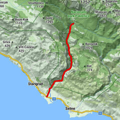
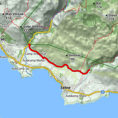
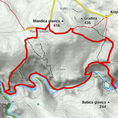
Gornji izvorMali Vlaškograd (1.174 m)0,8 kmPečica2,3 kmLibinjska kosa (900 m)5,5 kmLibinjska kosa5,7 kmGornja bukva9,9 kmBaričevići12,0 kmBaćin Stolac (912 m)12,5 kmKapljuv13,9 kmTulove grede (1.120 m)14,4 kmBaćin Stolac (912 m)16,3 kmBaričevići16,8 kmKraljičina vrata (972 m)18,2 kmCrveni potoci26,5 kmJelinov vršak (1.050 m)36,9 km
- Paras kausi
-
tammihelmimaalishuhtitoukokesäheinäelosyyslokamarrasjoulu
- Korkein kohta
- 1.283 m
- Kohde
-
Prezid
- Korkeusprofiili
-
 © outdooractive.com


-

-
KirjoittajaKiertue Via Dinarica HR-W-18 Southern Velebit (IV) – Tulove grede käyttää outdooractive.com toimitettu.


-
Obrovac
6