© NLW Tourismus Marketing GmbH - Tourismusinfo Nassfeld-Pressegger See
- Lyhyt kuvaus
-
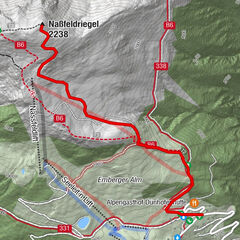
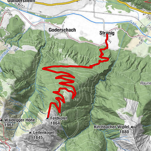
Anspruchsvolle Skitour mit Gipfelerlebnis am Feldkofel.
- Vaikeus
-
tapa
- Arviointi
-
- Reitti
-
Hl. Johannes der TäuferStranigUnterbuchacher Alm8,6 kmFeldkofel (1.864 m)11,9 km
- Paras kausi
-
elosyyslokamarrasjoulutammihelmimaalishuhtitoukokesäheinä
- Korkein kohta
- 1.857 m
- Kohde
-
Feldkofel
- Korkeusprofiili
-

- Kirjoittaja
-
Kiertue Feldkofel (1.864 m) über Unterbuchacher Alm käyttää outdooractive.com toimitettu.