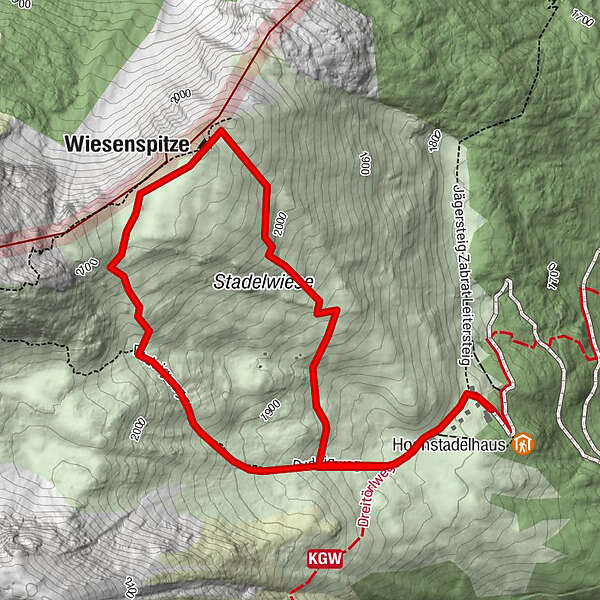
Edelweißwanderung zur Wiesenspitze

Logo Edelweißwanderung zur Wiesenspitze
Retkitiedot
3,02km
1.795 - 2.071m
Distanz
274hm
265hm
Nousu
02:00h
 
Kesto
Lyhyt kuvaus

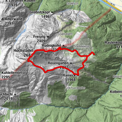
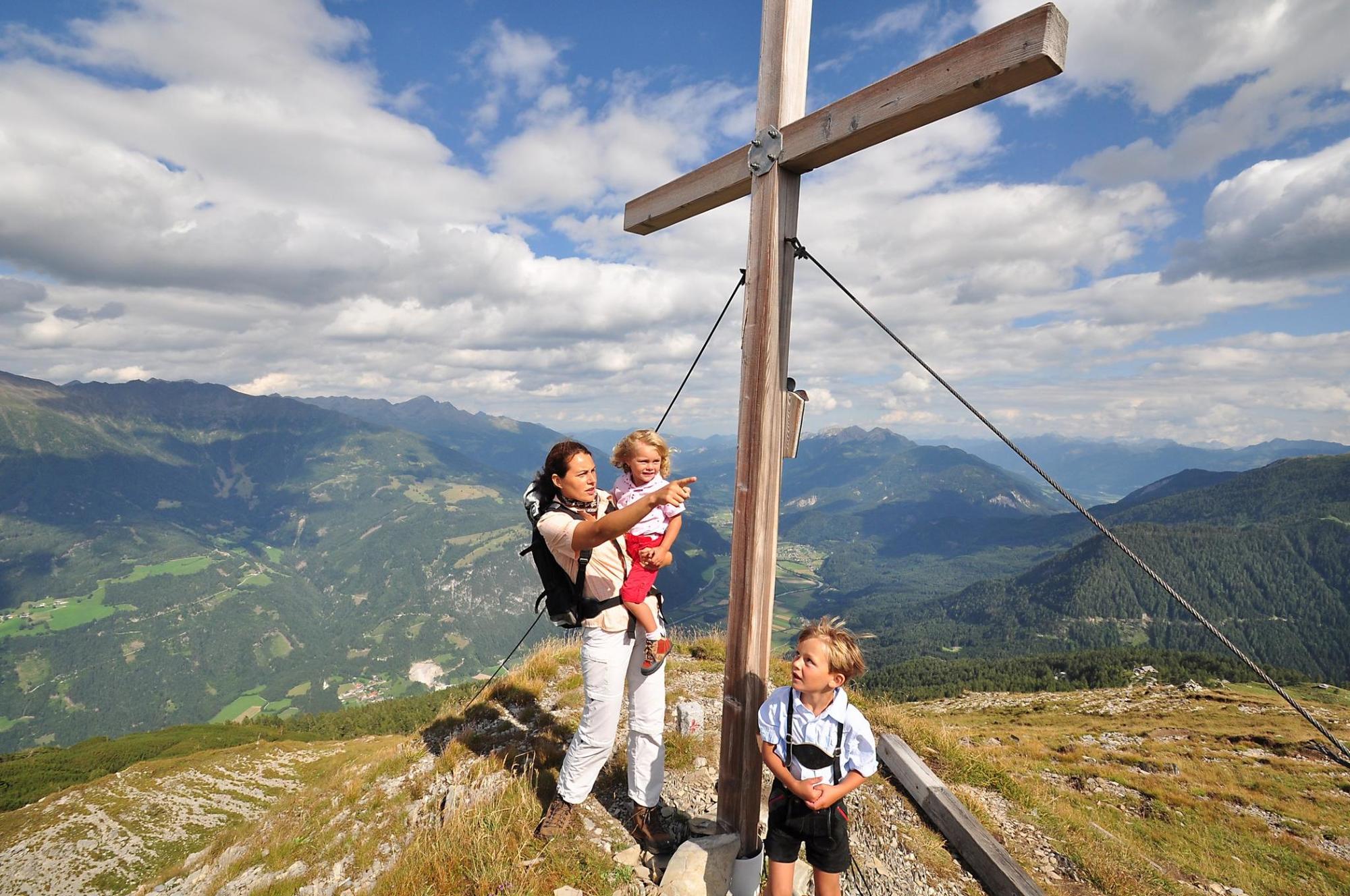
Einfache und aussichtsreiche Bergwanderung auf den Trabant des Hochstadels.

Vaikeus
tapa
Arviointi
Tekniikka
Kunto
Maisema
Elämys
Reitti
Wiesenspitze
1,5 km

Korkein kohta
2.071 m
Korkeusprofiili

Kirjoittaja

2,0
Yleinen luokitus

5

0

%

4

0

%

3

0

%

2

100

%

1

0

%

GPS Downloads
  • GPX GPS Exchange Format (XML)
  • KML Google Earth, Google Maps
QR-latauskoodit matkapuhelimiin

Suosittuja retkiä alueella

Gipfelwanderung zum Hochstadel

tapa
7,83km | 900hm | 05:00h

Wolayersee

tapa
7,11km | 811hm | 03:50h

Neualplseen

tapa
5,93km | 642hm | 05:00h