
- Lyhyt kuvaus
-
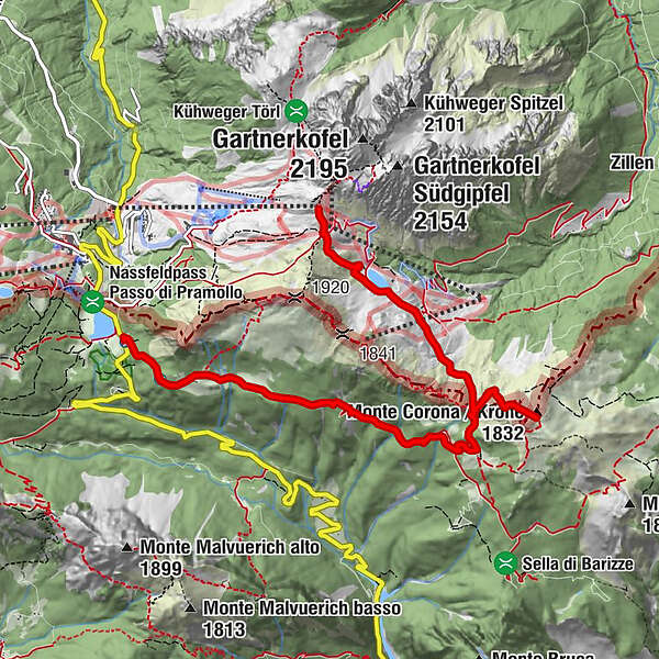
The crown is part of a geopoint. Geopoints are geologically and geomorphologically interesting points or areas in nature. This geopoint is located at the Geotrail Passo Pramollo wet field.
- Vaikeus
-
tapa
- Arviointi
-
- Reitti
-
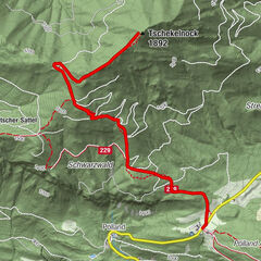
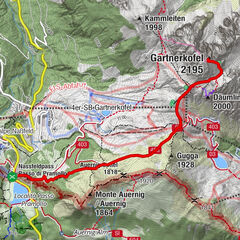
Krone (1.832 m)3,0 kmAuernil Quelle6,1 kmAlbergo Ristorante Wulfenia da Livio7,7 kmPasso Pramollo7,7 km
- Paras kausi
-
tammihelmimaalishuhtitoukokesäheinäelosyyslokamarrasjoulu
- Korkein kohta
- 1.864 m
- Kohde
-
Naßfeldpass
- Korkeusprofiili
-


- Kirjoittaja
-
Kiertue Geotrail Wanderung - Krone käyttää outdooractive.com toimitettu.
GPS Downloads


Yleistä tietoa
Virvokepysäkki
Lisää retkiä alueilla