Retkitiedot
9,53km
892
- 1.788m
937hm
942hm
05:00h
- Lyhyt kuvaus
-
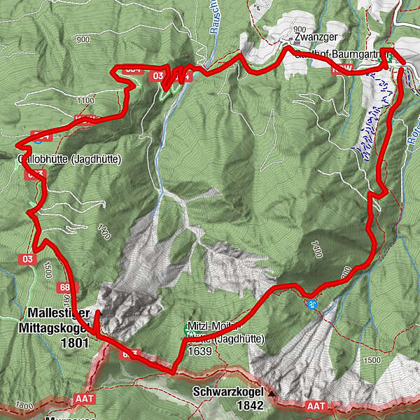
Ausgangspunkt: Baumgartner Höhe
- Vaikeus
-
tapa
- Arviointi
-
- Lähtöpiste
-
Baumgartner Höhe
- Reitti
-
Rotschitzawasserfall1,2 kmfountain/Brunnen7,5 kmHotel Restaurant Baumgartnerhof9,4 km
- Paras kausi
-
tammihelmimaalishuhtitoukokesäheinäelosyyslokamarrasjoulu
- Korkein kohta
- Malestiger Mittagskogel (1.788 m)
- Kohde
-
Baumgartner Höhe
- Lepo/Retriitti
-
Gasthaus Baumgartner
GPS Downloads


Polun olosuhteet
Asfaltti
Sora
Niitty
Metsä
Kallio
Altistettu
Lisää retkiä alueilla