© Visit Éislek

- Lyhyt kuvaus
-
From the leisurely afternoon round to the challenging hiking tour, everything is included in the Local Hiking Trails.
- Vaikeus
-
tapa
- Arviointi
-
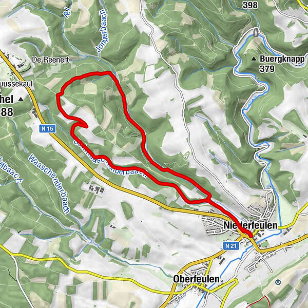
- Reitti
-
Niederfeulen0,1 kmNiederfeulen9,2 km
- Paras kausi
-
tammihelmimaalishuhtitoukokesäheinäelosyyslokamarrasjoulu
- Korkein kohta
- 478 m
- Kohde
-
Feulen
- Korkeusprofiili
-
 © outdooractive.com

- Kirjoittaja
-
Kiertue Local hiking trail FE 1 - Niederfeulen käyttää outdooractive.com toimitettu.