
- Lyhyt kuvaus
-
The CFL rail trails take you from one station to another, so you can easily get back to your starting point by train.
- Vaikeus
-
tapa
- Arviointi
-
- Reitti
-
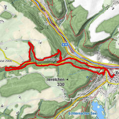
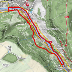
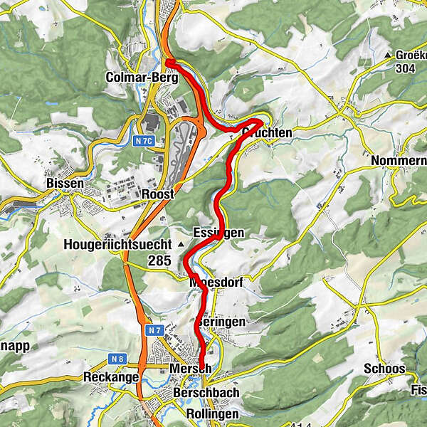
Colmar-Berg0,0 kmColmar0,1 kmColmar-Brücke0,5 kmCruchten3,5 kmCruchten4,3 kmEssingen6,4 kmPettingen7,7 kmDonatuskapell8,1 kmMoesdorf8,4 kmMersch10,3 km
- Paras kausi
-
tammihelmimaalishuhtitoukokesäheinäelosyyslokamarrasjoulu
- Korkein kohta
- 235 m
- Kohde
-
At the station in Mersch / Colmar-Berg
- Korkeusprofiili
-
 © outdooractive.com
- Kirjoittaja
-
Kiertue CFL-Bahnwanderweg 13 (Colmar-Berg - Mersch) käyttää outdooractive.com toimitettu.
GPS Downloads


Yleistä tietoa
Virvokepysäkki
Kulttuuri/Historiallinen
Lupaava