
- Lyhyt kuvaus
-
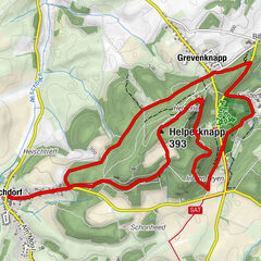
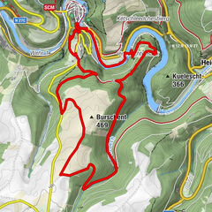
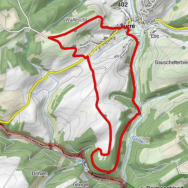
These traditional hiking trails, created by the Ministry of Economy, can be found all over Luxembourg. There are 43 of them in the Éislek region. You can easily reach their starting points by car. The Auto-Pédestre trails complement the other circular trails in the Éislek region perfectly.
- Vaikeus
-
helppo
- Arviointi
-
- Reitti
-
Saint-Lambert0,1 kmSyr0,1 kmSyr6,0 kmSaint-Lambert6,2 km
- Paras kausi
-
tammihelmimaalishuhtitoukokesäheinäelosyyslokamarrasjoulu
- Korkein kohta
- 453 m
- Kohde
-
8 Place de l'Eglise, Surré
- Korkeusprofiili
-
 © outdooractive.com
- Kirjoittaja
-
Kiertue Auto-Pédestre trail Surré käyttää outdooractive.com toimitettu.
GPS Downloads


Yleistä tietoa
Lupaava
Lisää retkiä alueilla