© Gauvin Lapetoule

© Thomas Linkel

© Youth hostel Remerschen

© Manuela Meyer

© Manuela Meyer

© Manuela Meyer

- Lyhyt kuvaus
-
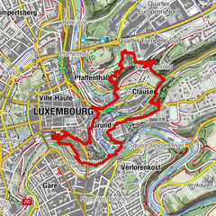
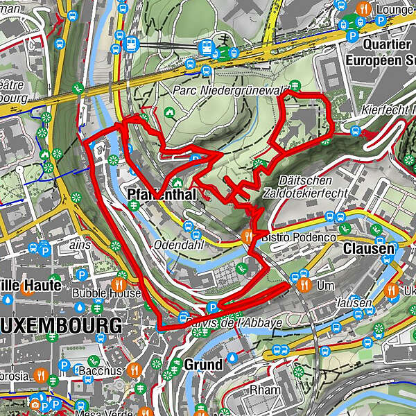
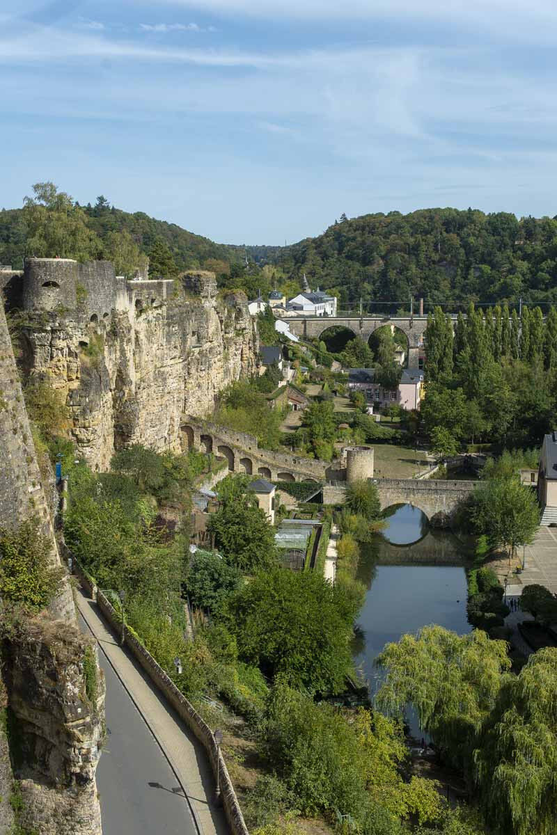
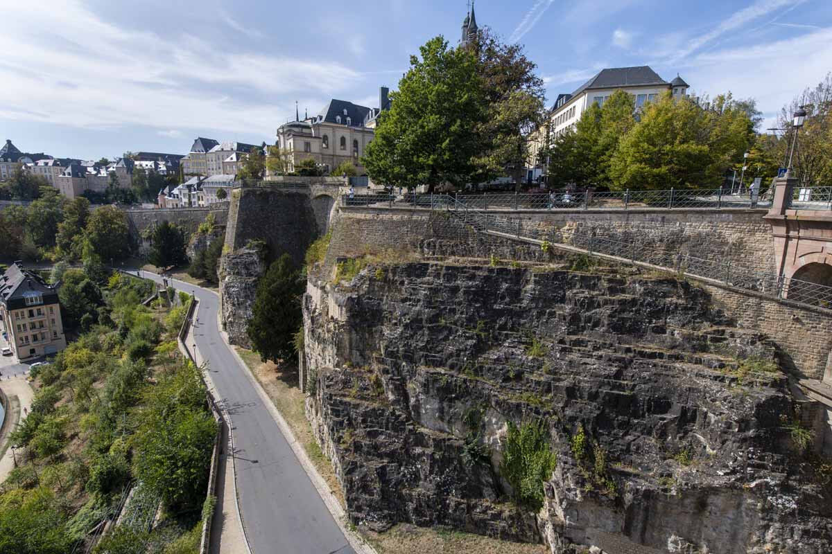
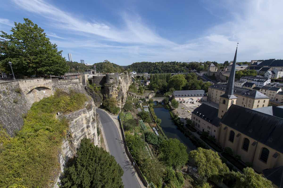
The Vauban circuit takes you through the historic parts of the city of Luxembourg, to the points of strategic importance in one of Europe’s most impressive fortresses.
- Vaikeus
-
tapa
- Arviointi
-
- Reitti
-
Bock0,0 kmÉglise Saint-Michel0,1 kmGrund0,2 kmLuxembourg0,4 kmThéiwesbur1,1 kmSaint-Mathieu1,1 kmPfaffenthal1,2 kmClausen4,9 km
- Paras kausi
-
tammihelmimaalishuhtitoukokesäheinäelosyyslokamarrasjoulu
- Korkein kohta
- 318 m
- Kohde
-
Bock Promontory, Montée de Clausen
- Korkeusprofiili
-
 © outdooractive.com
- Kirjoittaja
-
Kiertue Vauban Circular Walk käyttää outdooractive.com toimitettu.
GPS Downloads


Yleistä tietoa
Virvokepysäkki
Kulttuuri/Historiallinen
Lisää retkiä alueilla