© Donau Niederösterreich Tourismus GmbH - Donau Niederösterreich/www.extremfotos.com
© Donau Niederösterreich Tourismus GmbH - Donau Niederösterreich/Klaus Engelmayer
© Donau Niederösterreich Tourismus GmbH - Donau Niederösterreich/Klaus Engelmayer
© Donau Niederösterreich Tourismus GmbH - Donau Niederösterreich/Klaus Engelmayer
© Donau Niederösterreich Tourismus GmbH - Donau Niederösterreich/Klaus Engelmayer

© Donau Niederösterreich Tourismus GmbH - Donau Niederösterreich Tourismus

© Donau Niederösterreich Tourismus GmbH - Donau Niederösterreich Tourismus
© Donau Niederösterreich Tourismus GmbH - Donau Niederösterreich Tourismus
© Donau Niederösterreich Tourismus GmbH - Donau Niederösterreich Tourismus

- Lyhyt kuvaus
-
From the Bicycle Museum to the City of the Nibelungs
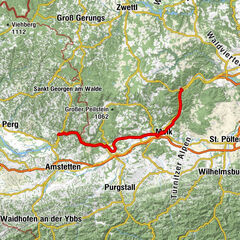
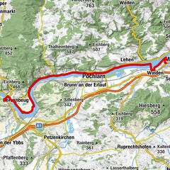
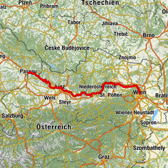
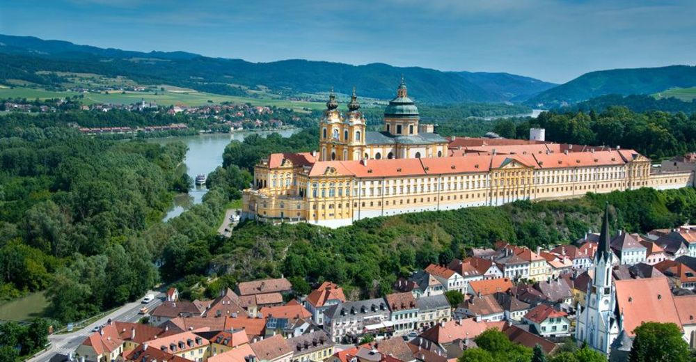
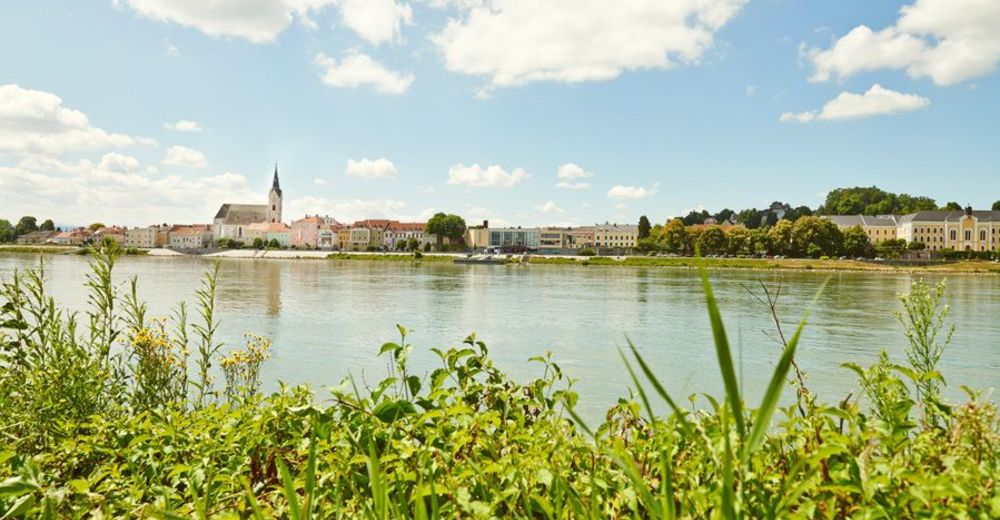
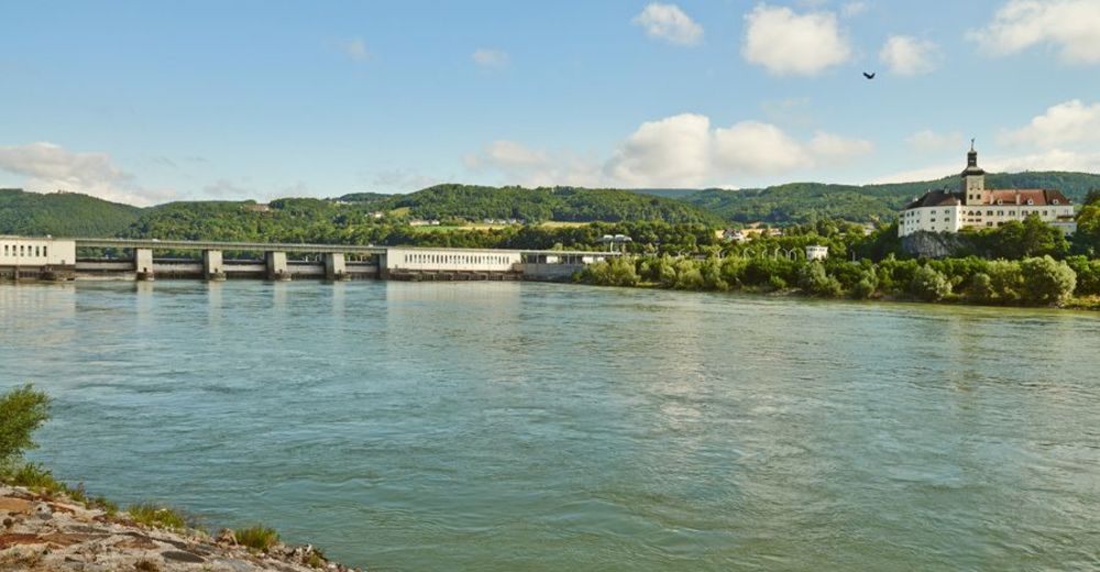
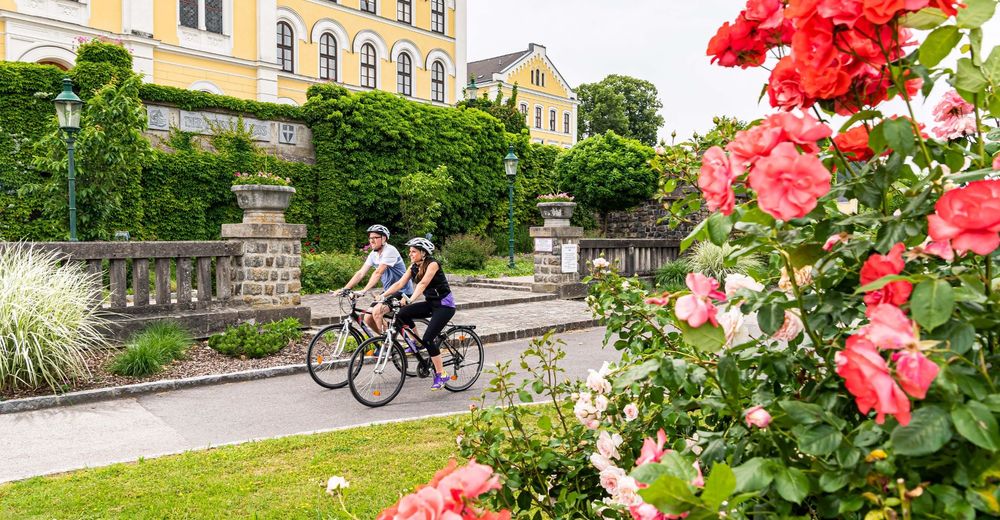
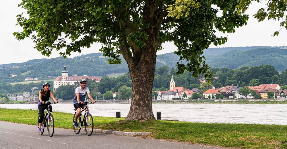
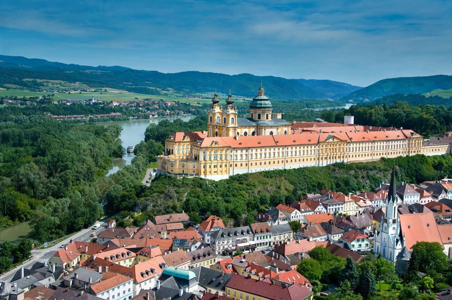
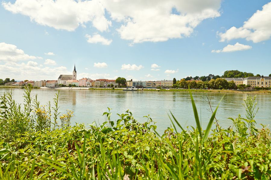
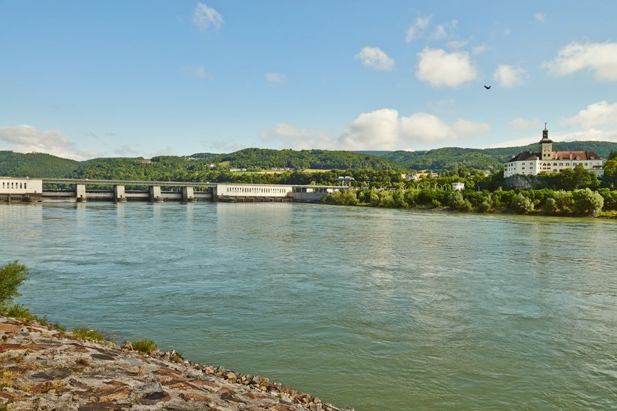
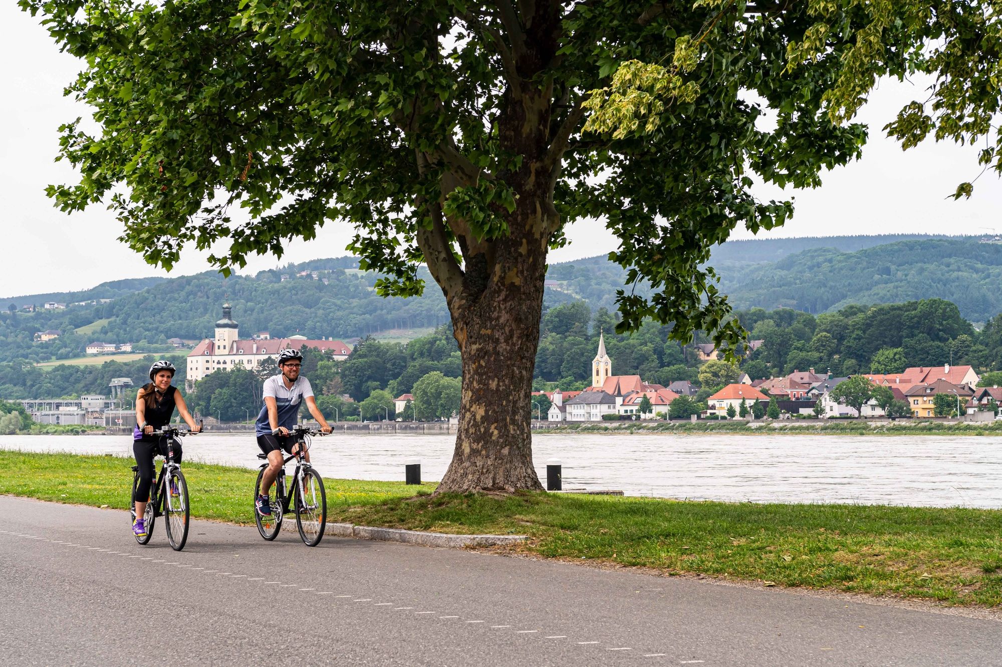
On this scenic long-distance bike path, you travel along the Danube from a small, quiet town called Ardagger to the city of Melk, the western gateway to the Wachau. In the picturesque Danube Valley, you pass through the towns of Hössgang, Ybbs an der Donau, Krummnussbaum and Pöchlarn, among others, before arriving in Melk, your destination.
- Vaikeus
-
tapa
- Arviointi
-
- Reitti
-
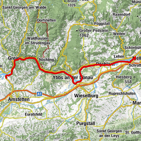
Ardagger Markt0,1 kmGasthaus Stöger0,1 kmGasthof Raderbauer-Mimmler0,8 kmSteckerlfisch2,6 kmGasthaus Zur Donaubrücke, Fam. Froschauer4,8 kmUfer6,0 kmGrein6,5 kmWiesen6,6 kmHößgang8,3 kmStruden9,5 kmSt. Nikola an der Donau10,3 kmSarmingstein12,9 kmGasthof Ziseritsch16,0 kmFreyenstein16,1 kmWillersbach18,0 kmGuesthouse Krenn18,1 kmTeuch20,8 kmDonaudorf23,4 kmBistro Mogador25,2 kmCalisthenics26,1 kmReifenlaufen26,1 kmLiegestützen26,1 kmArmzug26,1 kmRückenstrecken Universal26,1 kmBeinheber / Situps26,1 kmKipp-Gleiter26,1 kmSpringfeld26,1 kmOberkörper-Ergometer26,1 kmGehschule26,1 kmSchwebende Platform26,1 kmTrampolin26,1 kmPedalostrecke26,2 kmBalancierstrecke Bergheim26,2 kmKath. Pfarrkirche hl. Laurentius26,9 kmYbbs an der Donau26,9 kmSarling30,4 kmTheresien-Kapelle33,1 kmSäusenstein33,3 kmMetzling34,1 kmDiedersdorf34,8 kmMostheuriger Stöckl34,9 kmWallenbach36,3 kmAnnastift37,4 kmMarbach an der Donau37,8 kmKrummnußbaum38,4 kmAm Rechen41,1 kmHafenwirt41,2 kmPöchlarn42,6 kmMelk (213 m)53,3 km
- Paras kausi
-
tammihelmimaalishuhtitoukokesäheinäelosyyslokamarrasjoulu
- Korkein kohta
- 256 m
- Kohde
-
Melk
- Korkeusprofiili
-


- Kirjoittaja
-
Kiertue Danube Cycle Path, stage 4, south bank: Ardagger - Melk käyttää outdooractive.com toimitettu.
GPS Downloads


Yleistä tietoa
Virvokepysäkki
Kulttuuri/Historiallinen
Flora
Fauna
Lupaava
Lisää retkiä alueilla