Retkitiedot
16,99km
203
- 452m
521hm
536hm
05:00h

- Lyhyt kuvaus
-
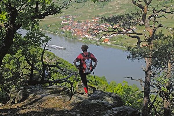
1. Etappe 3 Tages Weinwanderung
- Vaikeus
-
tapa
- Arviointi
-
- Reitti
-
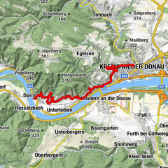
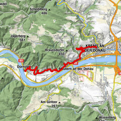
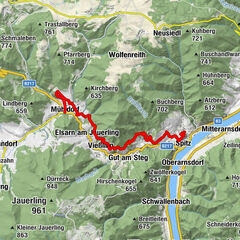
Furth bei Göttweig0,0 kmStiftskirche St. Maria1,6 kmKlein-Wien2,0 kmKapelle Aigen2,8 kmAigen2,9 kmMautern an der Donau6,8 kmFörthof7,5 kmPfarrkirche hl. Nikolaus8,3 kmStein an der Donau8,5 kmKrems an der Donau8,5 kmFrauenbergkirche8,5 kmRebentor8,6 kmDonauwarte (450 m)10,4 kmBraunsdorfer Berg (450 m)10,4 kmPfarrkirche Egelsee11,5 kmEgelsee11,5 kmIn der Gais14,8 kmInnenstadt16,2 kmKrems an der Donau16,3 kmKönigreichssaal von Jehovas Zeugen17,0 km
- Paras kausi
-
tammihelmimaalishuhtitoukokesäheinäelosyyslokamarrasjoulu
- Korkein kohta
- 452 m
GPS Downloads


Polun olosuhteet
Asfaltti
(70)
Sora
(15)
Niitty
Metsä
(15)
Kallio
Altistettu
Lisää retkiä alueilla
-
Donau Niederösterreich
2289
-
Kamptal - Manhartsberg
1159
-
Mautern an der Donau
697