Retkitiedot
6,68km
942
- 1.810m
1.056hm
1.056hm
05:30h

- Lyhyt kuvaus
-
Von Ranek auf den Rauen Kamm und Retour
- Vaikeus
-
vaikea
- Arviointi
-
- Lähtöpiste
-
Ranek
- Reitti
-
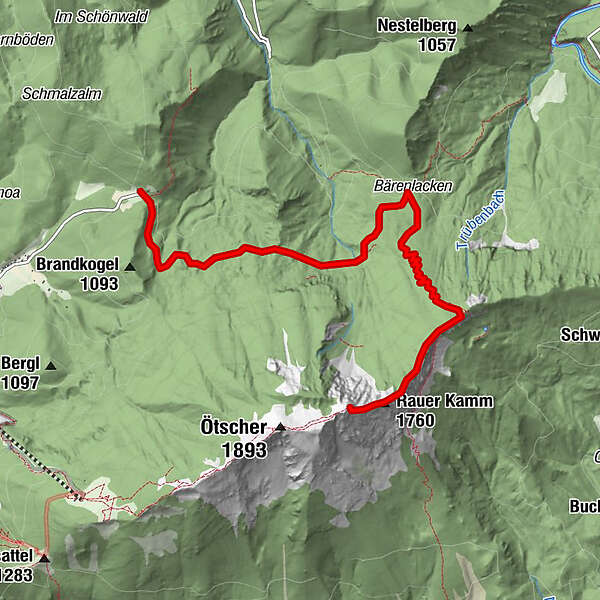
Raneck0,0 kmBärenlacken3,5 kmVersturzgangl4,3 kmFliegengangl5,7 kmBiwakhalbhöhle5,8 kmGamsgangl5,8 kmOstbandhöhle5,8 kmFlachgangl5,9 kmSisyphusloch6,1 kmRauher-Kamm-Mäander6,2 kmBlechdosenkluft6,2 kmGemsenhorst6,4 kmEinstiegsloch6,5 km
- Paras kausi
-
tammihelmimaalishuhtitoukokesäheinäelosyyslokamarrasjoulu
- Korkein kohta
- 1.810 m
- Kohde
-
Rauer Kamm Ende
- Lepo/Retriitti
-
Keine


