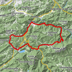
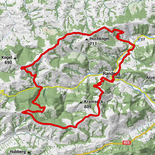
Retkitiedot
31km
341
- 830m
922hm
922hm
02:30h
- Lyhyt kuvaus
-
Randegger Mountainbikestrecke
- Vaikeus
-
tapa
- Arviointi
-
- Lähtöpiste
-
Badparkplatz Randegg
- Reitti
-
Randegg0,1 kmGruberkogel (740 m)3,6 kmFünfhaus15,2 kmPanoramastüberl21,2 kmPerwarth27,8 kmRandegg30,8 km
- Paras kausi
-
tammihelmimaalishuhtitoukokesäheinäelosyyslokamarrasjoulu
- Korkein kohta
- 830 m
- Kohde
-
Badparkplatz Randegg
- Lepo/Retriitti
-
Panoramastüberl ... www.panoramastueberl.at/
GPS Downloads


Ajoreitit
Asfaltti
Sora
Metsä
Vuoripolut
Singletrails
Trial
Liikenne
Lisää retkiä alueilla
-
Mostviertel
151
-
Eisenstraße Niederösterreich
65
-
Randegg
14