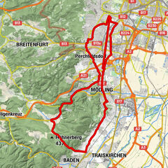
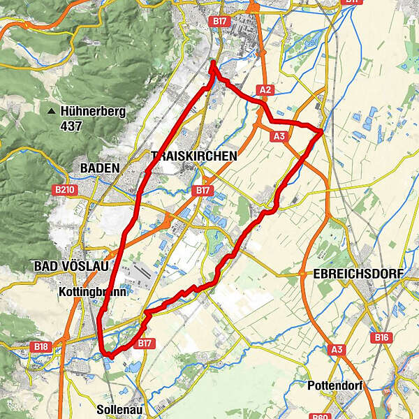
Rundstrecke Guntramsdorf-Bad Vöslau-Münchendorf-Guntramsdorf

Retkitiedot
41,6km
183
- 258m
68hm
32hm
01:45h
- Vaikeus
-
helppo
- Arviointi
-
- Korkein kohta
- 258 m
GPS Downloads


Ajoreitit
Asfaltti
Sora
Metsä
Vuoripolut
Singletrails
Trial
Liikenne
Lisää retkiä alueilla
-
Wienerwald
21
-
Traiskirchen
4