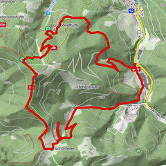
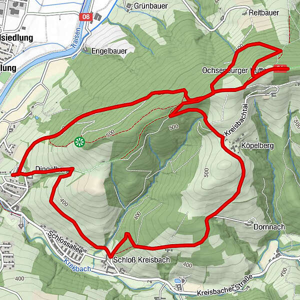
Retkitiedot
8,9km
356
- 584m
244hm
235hm
02:15h
- Vaikeus
-
helppo
- Arviointi
-
- Lähtöpiste
-
Wilhelmsburg
- Paras kausi
-
tammihelmimaalishuhtitoukokesäheinäelosyyslokamarrasjoulu
- Korkein kohta
- Rudolfshöhe (584 m)
- Kohde
-
Rudolfshöhe
- Lepo/Retriitti
-
Ochsenburger Hütte
GPS Downloads


Polun olosuhteet
Asfaltti
(800)
Sora
Niitty
Metsä
Kallio
Altistettu
Lisää retkiä alueilla
-
Donau Niederösterreich
2286
-
Traisen-Gölsental
1336
-
Wilhelmsburg
224