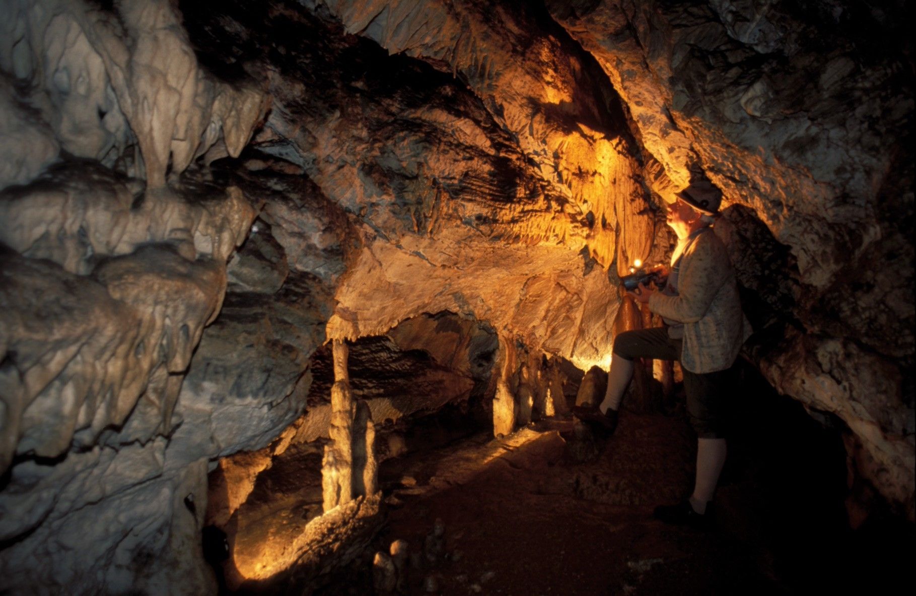
© Hans-Peter Wahl, Naturfreunde Kienberg/Gaming

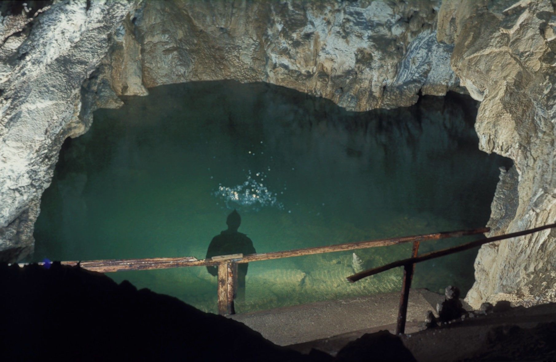
© Hans-Peter Wahl, Naturfreunde Kienberg/Gaming

© Hans-Peter Wahl, Naturfreunde Kienberg/Gaming
- Lyhyt kuvaus
-
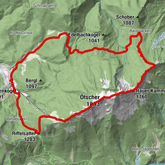
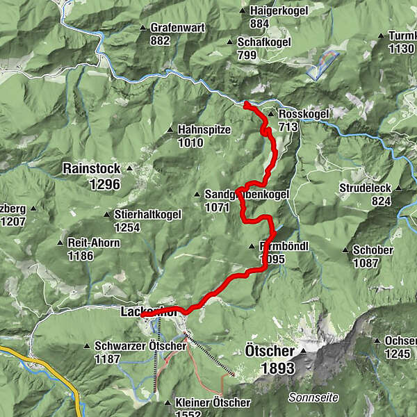
Wanderung zur Ötscher Tropfsteinhöhle im Naturpark Ötscher-Tormäuer
- Vaikeus
-
tapa
- Arviointi
-
- Reitti
-
Lackenhof0,2 kmGasthof Digruber1,6 kmRaneck3,2 kmÖtscher-Tropfsteinhöhle9,0 kmSchindlhütte10,1 km
- Paras kausi
-
tammihelmimaalishuhtitoukokesäheinäelosyyslokamarrasjoulu
- Korkein kohta
- 978 m
- Kohde
-
Schindlhütte
- Korkeusprofiili
-


- Kirjoittaja
-
Kiertue Lackenhof - Ötscher-Tropfsteinhöhle - Schindlhütte käyttää outdooractive.com toimitettu.
GPS Downloads


Yleistä tietoa
Virvokepysäkki
Lupaava
Lisää retkiä alueilla
-
Mostviertel
2454
-
Mariazellerland
1506
-
Lackenhof am Ötscher
418