- Lyhyt kuvaus
-
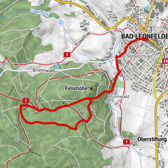
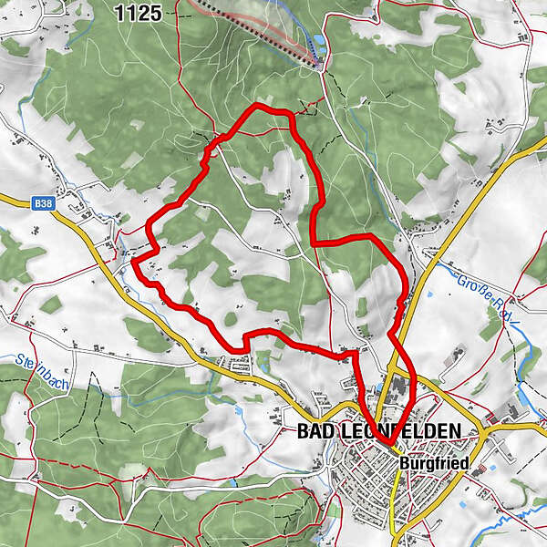
Route: Bad Leonfelden town square - Unterlaimbach - Amesberg - Waldschenke - Oberstern - Bad Leonfelden town square
- Vaikeus
-
tapa
- Arviointi
-
- Reitti
-
Leonfeldner HofHewal0,0 kmBad Leonfelden0,0 kmPfarrkirche Bad Leonfelden0,1 kmUnterlaimbach1,0 kmAmesberg3,2 kmWaldschenke am Sternstein5,2 kmNeumüllerkapelle10,0 kmLeonfeldner Hof10,1 kmBad Leonfelden10,2 kmHewal10,3 km
- Paras kausi
-
tammihelmimaalishuhtitoukokesäheinäelosyyslokamarrasjoulu
- Korkein kohta
- 959 m
- Korkeusprofiili
-

- Kirjoittaja
-
Kiertue 2 Waldschenke Round käyttää outdooractive.com toimitettu.
GPS Downloads


Lisää retkiä alueilla
-
Mühlviertel
1785
-
Mühlviertler Sterngartl
1065
-
Bad Leonfelden
268