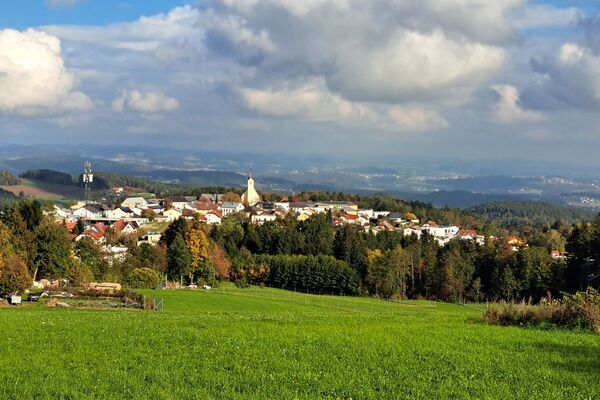
© Mühlviertler Hochland
- Lyhyt kuvaus
-
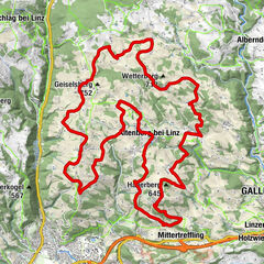
Route: City tour Bad Leonfelden - Ortschlag - Bernhardschlag - Stumpten - Vorderweißenbach - Kohlbach - Gaisschlag - Eberhardschlag - Amesschlag - Amesberg - City tour Bad Leonfelden
- Vaikeus
-
tapa
- Arviointi
-
- Reitti
-
Ortschlag1,4 kmBernhardschlag3,2 kmSchmankerlwirt6,7 kmVorderweißenbach6,8 kmBräugasthof Mascher6,9 kmKirche Vorderweißenbach6,9 kmGaisschlag10,1 kmEberhardschlag12,5 kmAmesschlag14,4 kmAmesberg15,9 km
- Paras kausi
-
tammihelmimaalishuhtitoukokesäheinäelosyyslokamarrasjoulu
- Korkein kohta
- 942 m
- Korkeusprofiili
-


- Kirjoittaja
-
Kiertue S5 Vorderweißenbacher Round käyttää outdooractive.com toimitettu.
GPS Downloads


Lisää retkiä alueilla
-
Mühlviertel
215
-
Mühlviertler Hochland
122
-
Vorderweißenbach
53