© WGD Donau Oberösterreich Tourismus GmbH/Weissenbrunner - Weissenbrunner

© WGD Donau Oberösterreich Tourismus GmbH/Weissenbrunner - Weissenbrunner


- Lyhyt kuvaus
-
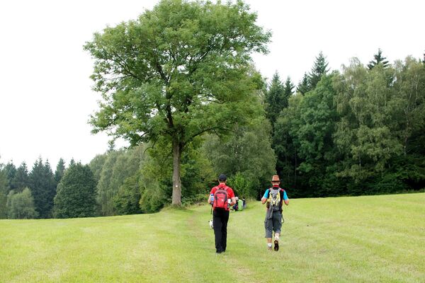
Hiking trail offering fantastic views of the Mühlviertel district, the foothills of the Alps and the Schlögen Danube Loop.
- Vaikeus
-
tapa
- Arviointi
-
- Reitti
-
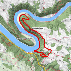
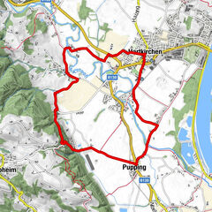
St. Agatha (603 m)Scharzeredt0,7 kmEtzing (615 m)1,7 kmBräuleiten3,0 kmMitterberg5,0 kmHauskapelle Hotel Donauschlinge5,8 kmSchlögen5,8 kmSchlögener Blick7,3 kmSchlögenleiten7,8 kmLinetshub8,4 kmDorf11,0 kmHaibach ob der Donau11,3 kmDonauleiten12,6 kmWiesing13,9 kmDunzing (536 m)17,4 kmMiniwirt19,4 kmSt. Agatha (603 m)20,5 km
- Paras kausi
-
tammihelmimaalishuhtitoukokesäheinäelosyyslokamarrasjoulu
- Korkein kohta
- 625 m
- Kohde
-
Ortszentrum St. Agatha
- Korkeusprofiili
-


- Kirjoittaja
-
Kiertue St. Agatha: “Es muss sein” (“It has to be”) Trail käyttää outdooractive.com toimitettu.
GPS Downloads


Yleistä tietoa
Virvokepysäkki
Lupaava
Lisää retkiä alueilla