© WGD Donau Oberösterreich Tourismus GmbH/Weissenbrunner - Weissenbrunner

- Lyhyt kuvaus
-
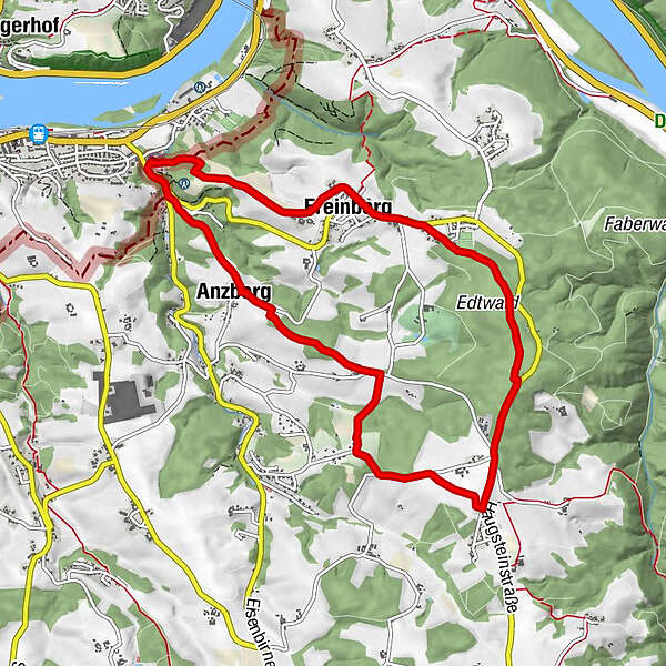
Hareth - Anzberg - Haibach-Maria im Walde – View of Passau from Unterfreinberg - Freinberg
Scenic, with refreshment stop
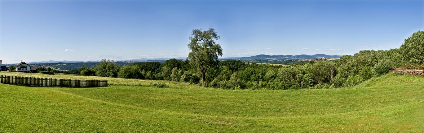
This scenic tour takes you through the hills and valleys of Freinberg and to the most beautiful vantage points over the three-river city of Passau and the view into the Bavarian Forest. A detour to the local history museum "Altes Forsthaus" or the bee nature trail is worthwhile. You can relax in our cosy inns and beer gardens.
- Vaikeus
-
helppo
- Arviointi
-
- Reitti
-
FreinbergPassau (312 m)Pfarrkirche Freinberg0,0 kmWeinbeißer0,1 kmHareth2,9 kmGasthaus Wirt z'Hareth2,9 kmAnzberg6,1 kmHaibach bei Schärding7,0 kmPassau (312 m)7,2 kmMaria im Walde7,7 kmPassaublick9,0 kmKapelle9,1 kmFreinberg9,3 kmPfarrkirche Freinberg9,5 km
- Paras kausi
-
tammihelmimaalishuhtitoukokesäheinäelosyyslokamarrasjoulu
- Korkein kohta
- 493 m
- Kohde
-
Town square in Freinberg
- Korkeusprofiili
-

- Kirjoittaja
-
Kiertue Freinberg: Passau View – Severinsweg Trail käyttää outdooractive.com toimitettu.
GPS Downloads


Yleistä tietoa
Virvokepysäkki
Lupaava
Lisää retkiä alueilla
-
Innviertel
797
-
Passauer Land
161
-
Freinberg
50