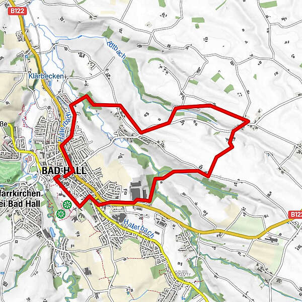
Retkitiedot
9,67km
347
- 408m
103hm
03:00h
- Lyhyt kuvaus
-
12 Waldandacht Rundwanderweg
- Vaikeus
-
helppo
- Arviointi
-
- Reitti
-
Bad HallOrtmühle2,2 kmGroßmengersdorf4,4 kmLandgasthaus Bachmayr4,5 kmKleinmengersdorf6,7 kmBad Hall9,3 km
- Paras kausi
-
tammihelmimaalishuhtitoukokesäheinäelosyyslokamarrasjoulu
- Korkein kohta
- 408 m

GPS Downloads


Polun olosuhteet
Asfaltti
(75%)
Sora
(10%)
Niitty
(10%)
Metsä
(5%)
Kallio
Altistettu
Lisää retkiä alueilla
-
Traunviertel
1940
-
Tourismusregion Bad Hall
770
-
Bad Hall
141