
© Dümlerhütte
© TVB Pyhrn-Priel/Sulzbacher
Retkitiedot
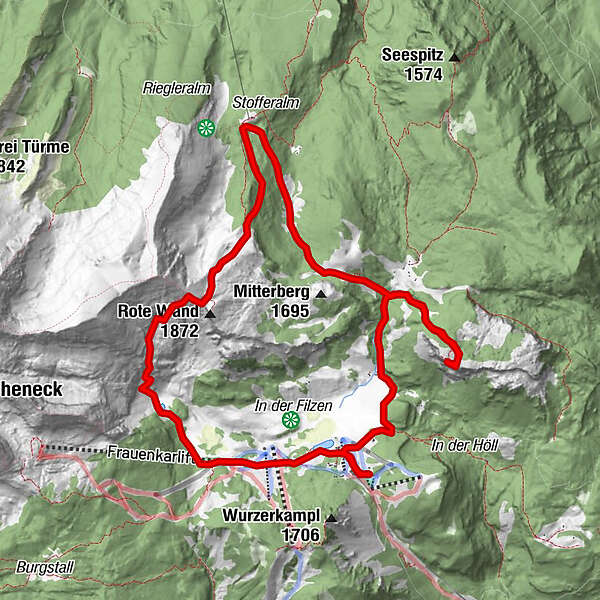
12,06km
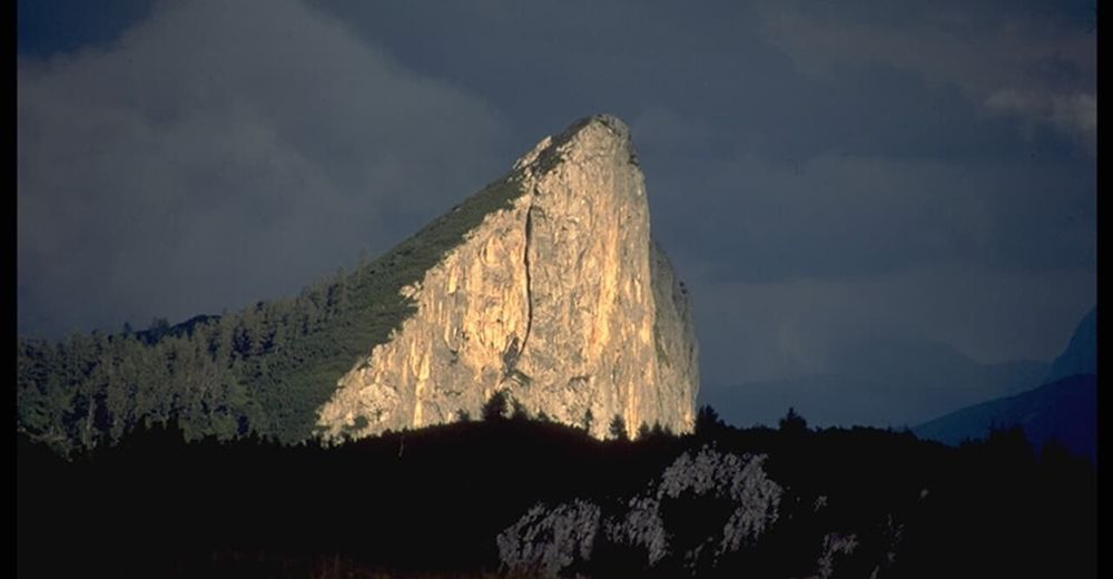
- 1.872m
1.000hm
06:00h
- Lyhyt kuvaus
-
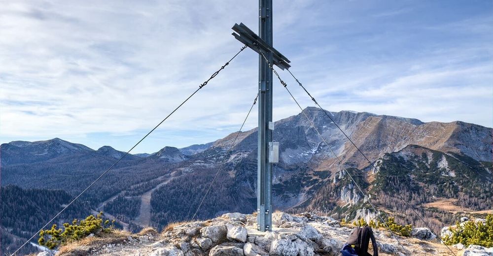
Rundwanderung an der Waldgrenze über Almböden und durch Lärchenwälder mit möglichem Einschluss 2er Aussichtsgipfel.
- Vaikeus
-
tapa
- Arviointi
-
- Lähtöpiste
-
Wurzeralm (1427 m, Bergstation Standseilbahn)
- Paras kausi
-
tammihelmimaalishuhtitoukokesäheinäelosyyslokamarrasjoulu
- Korkein kohta
- 1.872 m
- Lepo/Retriitti
-
Etliche Gasthöfe und Linzerhaus (ÖAV) auf der Wurzeralm (ganzjährig geöffnet), Dümlerhütte (Anfang Mai bis Ende Oktober geöffnet)
- Karttamateriaali
-
Wanderkarte Pyhrn-Priel erhätlich in allen Pyhrn-Priel Tourismusbüros!


GPS Downloads


Polun olosuhteet
Asfaltti
Sora
Niitty
Metsä
Kallio
Altistettu
Lisää retkiä alueilla
-
Gesäuse
2226
-
Urlaubsregion Pyhrn - Priel
1440
-
Spital am Pyhrn - Wurzeralm
434


