© Foto: OÖ Tourismus, Röbl

- Lyhyt kuvaus
-
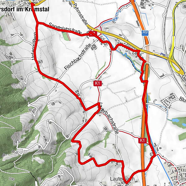
Circular trail with a view of the beautiful scenery of the Upper Krems Valley
- Vaikeus
-
helppo
- Arviointi
-
- Reitti
-
Inzersdorf im Kremstal0,1 kmLauterbach4,1 kmInzersdorf im Kremstal8,0 km
- Paras kausi
-
tammihelmimaalishuhtitoukokesäheinäelosyyslokamarrasjoulu
- Korkein kohta
- 488 m
- Kohde
-
Inzersdorf/center of the village
- Korkeusprofiili
-

- Kirjoittaja
-
Kiertue Circular trail under the mountains in Inzersdorf käyttää outdooractive.com toimitettu.
GPS Downloads


Yleistä tietoa
Virvokepysäkki
Lisää retkiä alueilla
-
Traunviertel
1939
-
Tourismusregion Bad Hall
768
-
Inzersdorf im Kremstal
253