Retkitiedot
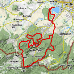
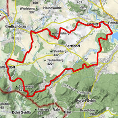
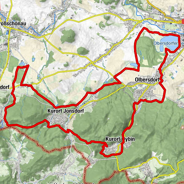
35,59km
232
- 577m
640hm
02:30h
- Lyhyt kuvaus
-
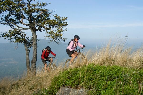
Leichte Einstiegstour über 36 Kilometer.
- Arviointi
-
- Lähtöpiste
-
Zeltplatz Olbersdorfer See
- Reitti
-
Zittau (242 m)Oybintal6,0 kmOybin (289 m)8,6 kmOybin8,9 kmFörster10,4 kmHausgipfel (Höllestein)10,8 kmHöllenkanzel11,1 kmTom's Rock11,2 kmThomaswarte11,2 kmHölle11,3 kmKäseecke11,4 kmSpitzstein13,2 kmBärwandkopf14,3 kmGondelfahrt15,1 kmMonk's Pocket Guard15,9 kmChristels Ecke18,9 kmSaalendorf23,2 kmKurort Jonsdorf25,8 kmHörnitzer Höhe33,9 kmCaptain Hook34,4 kmLa Montanara34,7 kmHaus am See35,1 kmZittau (242 m)35,5 km
- Korkein kohta
- 577 m
GPS Downloads


Ajoreitit
Asfaltti
Sora
Vuoripolut
Singletrails
Trial
Liikenne
Lisää retkiä alueilla