


- Lyhyt kuvaus
-
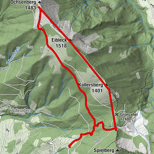
Spielbergstrasse-branch Eibleck-Ochsenberg (ÖAV trail 852a)-Eibleck-Kallersberg-Moserdenkmal-branch Eibleck-Spielbergstrasse
- Vaikeus
-
tapa
- Arviointi
-
- Reitti
-
Ochsenberg (1.483 m)2,9 kmEibleck (1.518 m)3,8 kmKallersberg (1.401 m)4,0 kmGrünsattel (1.240 m)4,3 km
- Paras kausi
-
tammihelmimaalishuhtitoukokesäheinäelosyyslokamarrasjoulu
- Korkein kohta
- 1.509 m
- Kohde
-
Maut Spielbergstrasse
- Korkeusprofiili
-


- Kirjoittaja
-
Kiertue Eibleck high trail, circular trail (No.69 V2) (6 points) käyttää outdooractive.com toimitettu.
GPS Downloads


Yleistä tietoa
Lupaava
Lisää retkiä alueilla


