© Gasteinertal Tourismus - Creatina Werbedesign & Photography

- Lyhyt kuvaus
-
Für den geübten Wanderer!
- Reitti
-
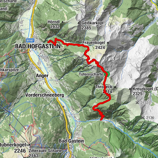
KötschachtalHermann Altenhuber Platzl0,7 kmPoserhöhe1,9 kmGamskarkogelhütte (2.465 m)7,2 kmGamskarkogel (2.467 m)7,3 kmRauchkogelscharte (2.205 m)8,8 kmAnnakapelle14,3 kmBad Hofgastein14,4 km
- Korkein kohta
- 2.456 m
- Kohde
-
Bad Hofgastein Ortszentrum
- Korkeusprofiili
-

- Kirjoittaja
-
Kiertue Gamskarkogel (Bad Gastein - Bad Hofgastein) käyttää outdooractive.com toimitettu.