© Gästeservice Tennengau - Tourismusverband Russbach
- Lyhyt kuvaus
-
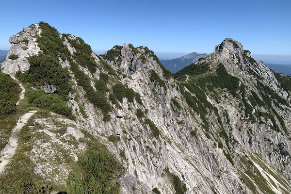
Magnificent mountain tour to the top of the highest peak in the Osterhorn Group, generally through steep and unforested terrain.
- Vaikeus
-
tapa
- Arviointi
-
- Reitti
-
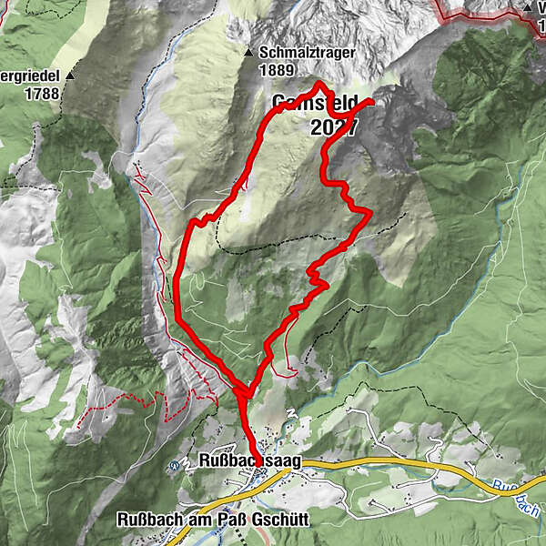
RußbachsaagKirchenwirtGamsfeld (2.027 m)5,5 kmAngerkarhütte7,7 kmRußbachsaag11,3 kmKirchenwirt11,4 kmPfarrkirche zum Hl. Kreuz11,4 km
- Paras kausi
-
tammihelmimaalishuhtitoukokesäheinäelosyyslokamarrasjoulu
- Korkein kohta
- 2.020 m
- Kohde
-
Village Squarre Russbach
- Korkeusprofiili
-


- Kirjoittaja
-
Kiertue Russbach: Traunwand-Gamsfeld-Angerkaralm (14 Punkte) käyttää outdooractive.com toimitettu.
GPS Downloads


Yleistä tietoa
Lupaava
Lisää retkiä alueilla