© Michael Kleinsasser

© Michael Kleinsasser

© Michael Kleinsasser

© Michael Kleinsasser

© Michael Kleinsasser

© Michael Kleinsasser
Retkitiedot
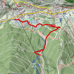
10,39km
1.720
- 2.192m
639hm
645hm
03:50h
- Lyhyt kuvaus
-
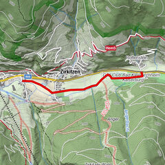
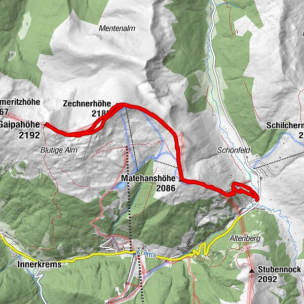
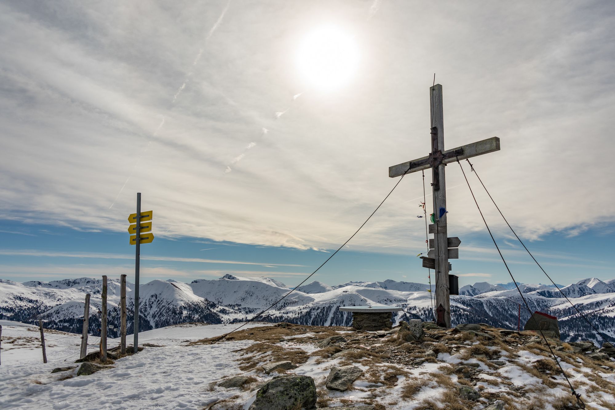
Von der Mehrl Hütte über Matehanshöhe, Zechnerhöhe auf die Gaipahöhe (1 Gipfelkreuz) und zurück
- Vaikeus
-
tapa
- Arviointi
-
- Lähtöpiste
-
Dr. Josef Mehrl Hütte
- Reitti
-
Dr.Josef-Mehrl-Hütte0,0 kmMatehanshöhe (2.086 m)1,7 kmZechnerhöhe (2.188 m)3,6 kmGaipahöhe (2.192 m)5,1 kmZechnerhöhe (2.188 m)6,6 kmMatehanshöhe (2.086 m)8,6 kmDr.Josef-Mehrl-Hütte10,3 km
- Paras kausi
-
elosyyslokamarrasjoulutammihelmimaalishuhtitoukokesäheinä
- Korkein kohta
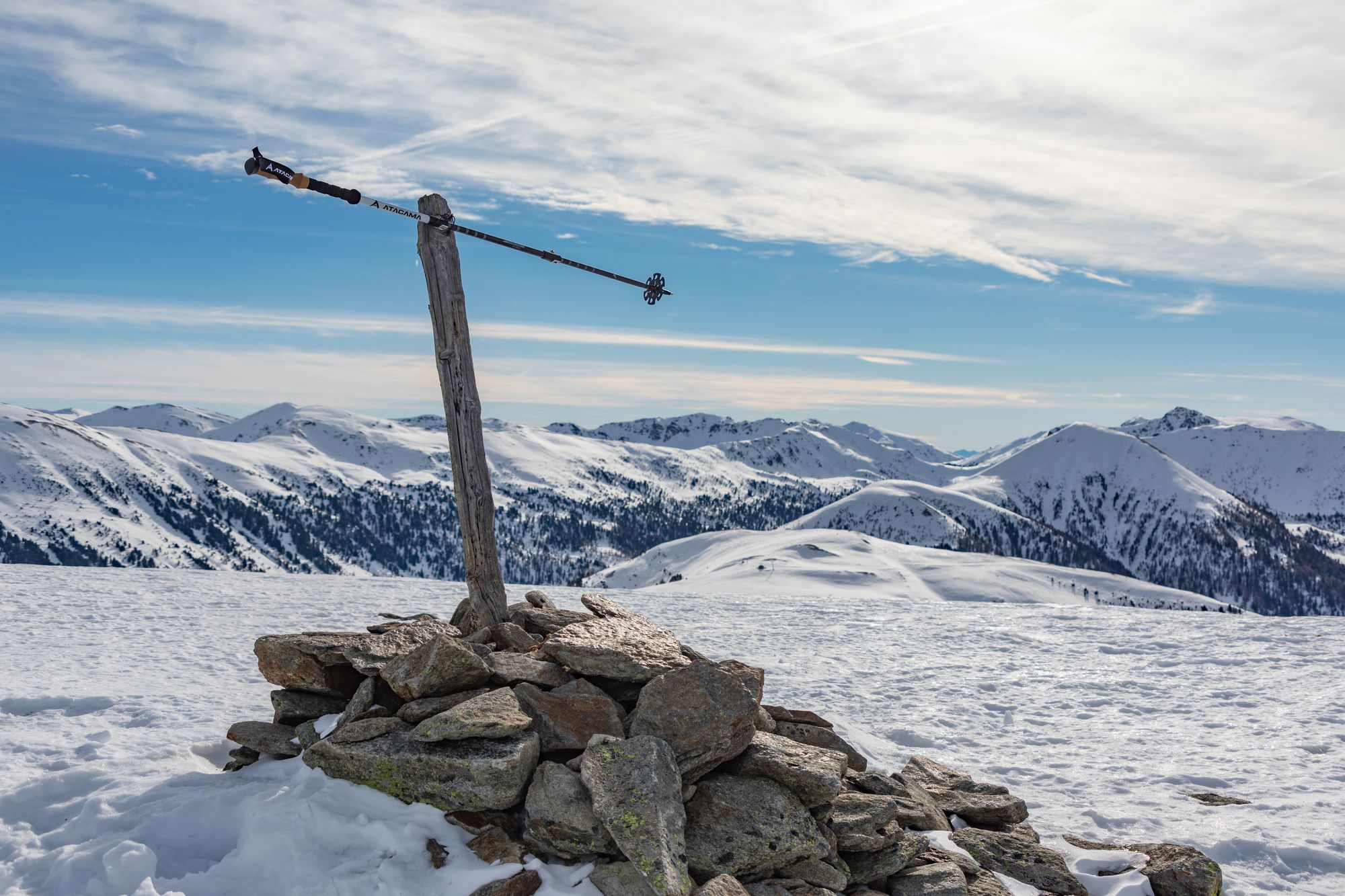
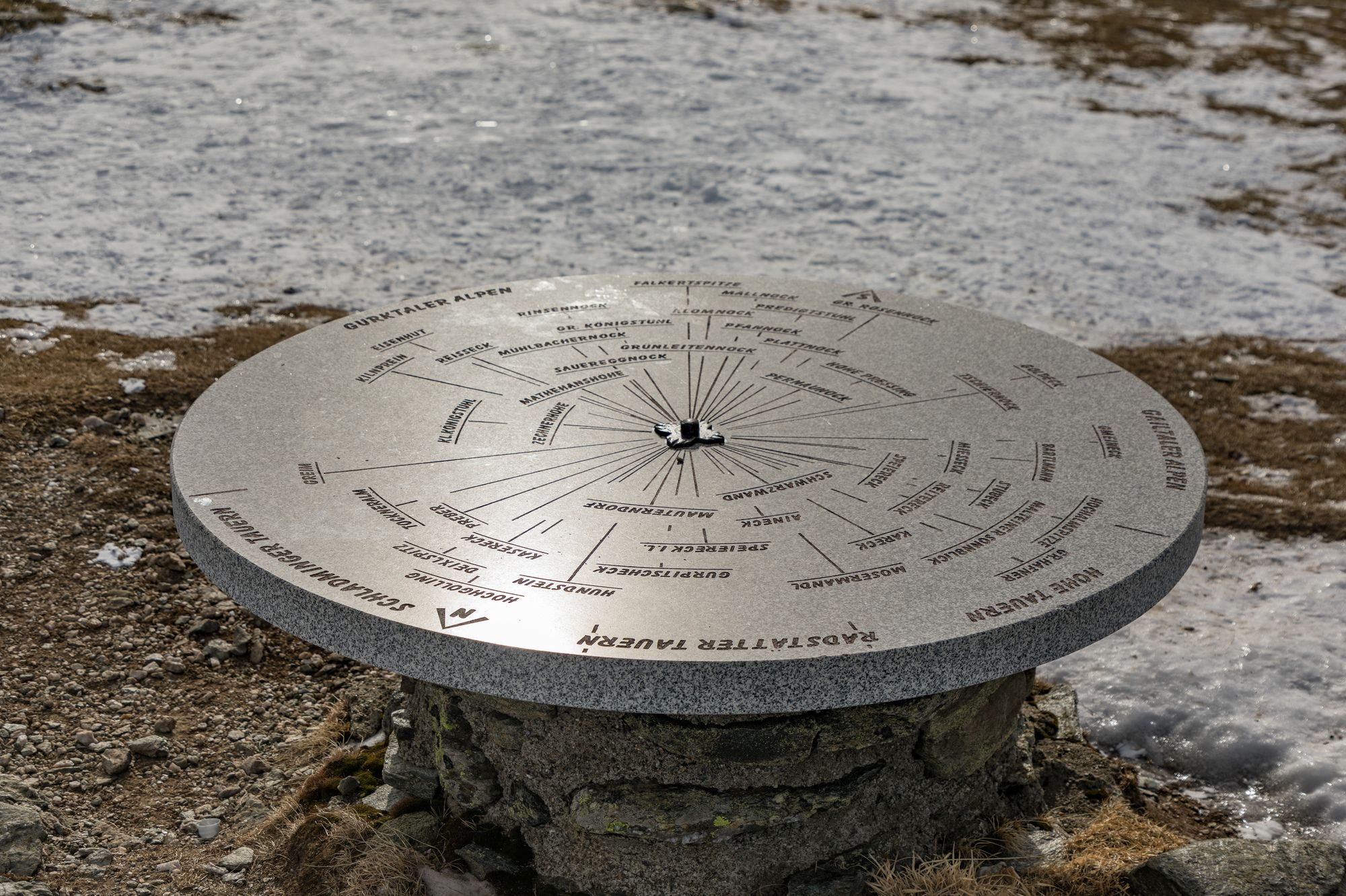
- Gaipahöhe (2.192 m)
- Kohde
-
Gaipahöhe
- Lepo/Retriitti
-
Mehrl Hütte


- Lähde
- Mike