© Oststeiermark Tourismus - Birgit Kandlbauer

© Oststeiermark Tourismus - Birgit Kandlbauer

© Oststeiermark Tourismus - Birgit Kandlbauer

© Oststeiermark Tourismus - Birgit Kandlbauer

© Oststeiermark Tourismus - TV Joglland-Waldheimat
- Lyhyt kuvaus
-
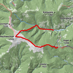
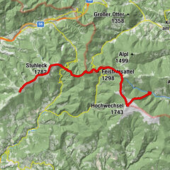
From the UNESCO World Heritage Site of Semmering or the high-altitude health resort of Fischbach to the edge of the Pannonian plain near Köszeg, a trail full of variety and attractions of nature leads: alpannonia®.
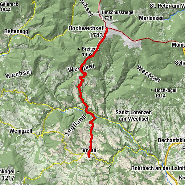
It is also possible to start the alpannonia trail, as in this case, in Vorau or Mönichwald and hike from there to the 1743 m high Hochwechsel. From there, the main trail continues to Mönichkirchen, Hochneukirchen, Bernstein, Oberkohlstätten and finally to the destination, Köszeg.
- Vaikeus
-
vaikea
- Arviointi
-
- Reitti
-
Kutscherwirt Hotel-Restaurant0,2 kmGasthof Pension „Vorauerhof“0,5 kmVorau0,6 kmFilialkirche Marktkirche hl. Ägydius0,6 kmRiegersbach2,0 kmWeißenbach3,8 kmLandhotel Mönichwalderhof6,6 kmMönichwald6,6 kmPfarrkirche hll. Peter und Paul6,7 kmUnter der Alm10,3 kmBerggasthof Schwengerer11,2 kmOchsenloch Hütte12,3 kmGemeindkreuz14,6 kmKaltwiesen Hütte15,5 kmHochwechsel (1.743 m)19,5 km
- Paras kausi
-
tammihelmimaalishuhtitoukokesäheinäelosyyslokamarrasjoulu
- Korkein kohta
- 1.733 m
- Kohde
-
Wetterkoglerhaus on the Hochwechsel
- Korkeusprofiili
-


- Kirjoittaja
-
Kiertue "alpannonia" - feeder: Vorau - Mönichwald - Hochwechsel käyttää outdooractive.com toimitettu.
GPS Downloads


Yleistä tietoa
Virvokepysäkki
Kulttuuri/Historiallinen
Lupaava
Lisää retkiä alueilla
-
Wiener Alpen
3048
-
Joglland - Waldheimat
1513
-
Waldbach-Mönichwald
308