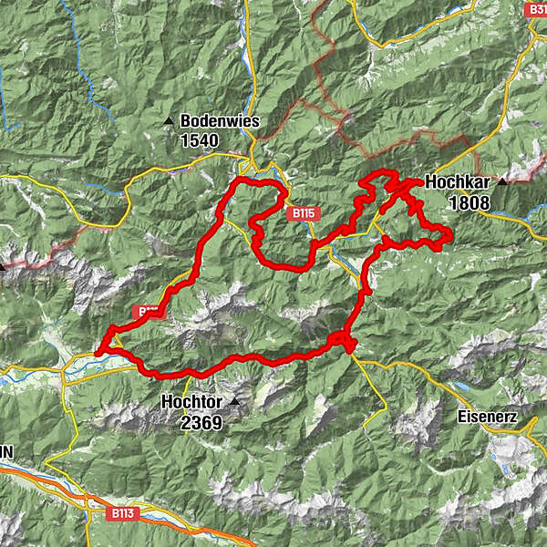
Retkitiedot
124,8km
422
- 1.236m
3.481hm
3.465hm
06:56h
- Lyhyt kuvaus
-
Video, Fotos und Bericht gibt es hier: stefankmtb.weebly.com/buchsteinrunde....
- Vaikeus
-
tapa
- Arviointi
-
- Reitti
-
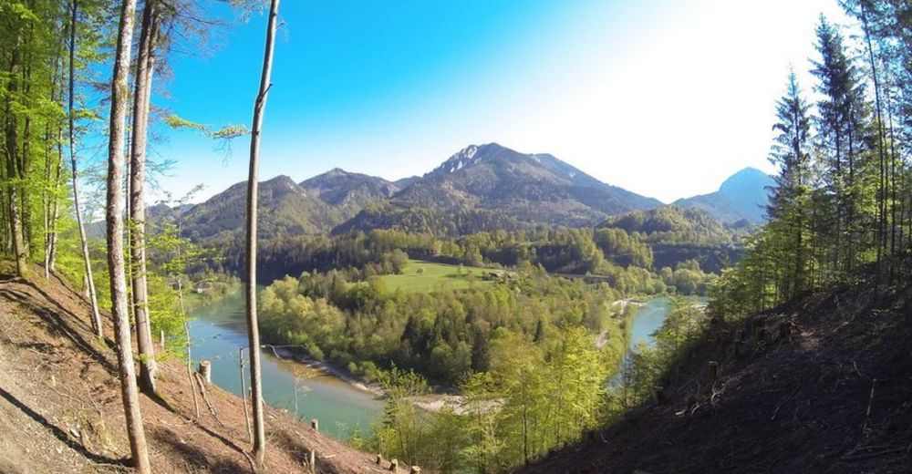
Sankt Gallen0,0 kmUnterer Markt0,2 kmAm Spitzenberg0,6 kmRestaurant Caffe Lounge Ivo1,3 kmWeißenbach an der Enns1,6 kmHocherb15,8 kmGasthof Schnabl18,1 kmGroßreifling20,8 kmFilialkirche Hl. Nikolaus20,9 kmSulzbachalm29,7 kmGamssteinhals (930 m)33,0 kmBergbauern - Lackneralmhütte35,7 kmPalfau40,6 kmSandloch40,8 kmLöschwasser Entnahmstelle42,4 kmSchwefelquelle63,0 kmGams bei Hieflau65,6 kmForstauers Brauhaus Gesäuse65,7 kmPfarrkirche hl. Joseph65,8 kmMooslandl68,4 kmGasthaus Mooswirt68,4 kmLainbach70,6 kmPoststüberl70,7 kmHarmonika Waldi73,0 kmWandau73,1 kmWegkapelle73,3 kmGasthof International75,9 kmGasthof International83,0 kmHieflau83,3 kmHieflau83,8 kmGstatterboden92,9 kmGstatterboden im Nationalpark93,1 kmWeng im Gesäuse104,9 kmGasthaus Wengerwirt105,0 kmGasthaus Gesäuseblick105,9 kmGriesbach118,3 kmPölzau119,6 kmOberreith120,1 kmBuchau120,8 kmOberhof122,6 kmAuf der Au123,0 kmOberer Markt123,7 kmSankt Gallen124,0 kmGasthof Hensle124,1 kmKirchenviertel124,1 kmMarkt124,2 kmHeurigenstube Angerer124,3 kmUnterer Markt124,6 km
- Paras kausi
-
tammihelmimaalishuhtitoukokesäheinäelosyyslokamarrasjoulu
- Korkein kohta
- 1.236 m

GPS Downloads


Lisää retkiä alueilla
-
Gesäuse
151
-
Steyr und die Nationalpark Region
116
-
Landl
12