© Erlebnisregion Thermen- & Vulkanland - Jörg Liemandt

© Erlebnisregion Thermen- & Vulkanland - Johann Gollowitsch

© Erlebnisregion Thermen- & Vulkanland - Jörg Liemandt

© Erlebnisregion Thermen- & Vulkanland - Jörg Liemandt

- Lyhyt kuvaus
-
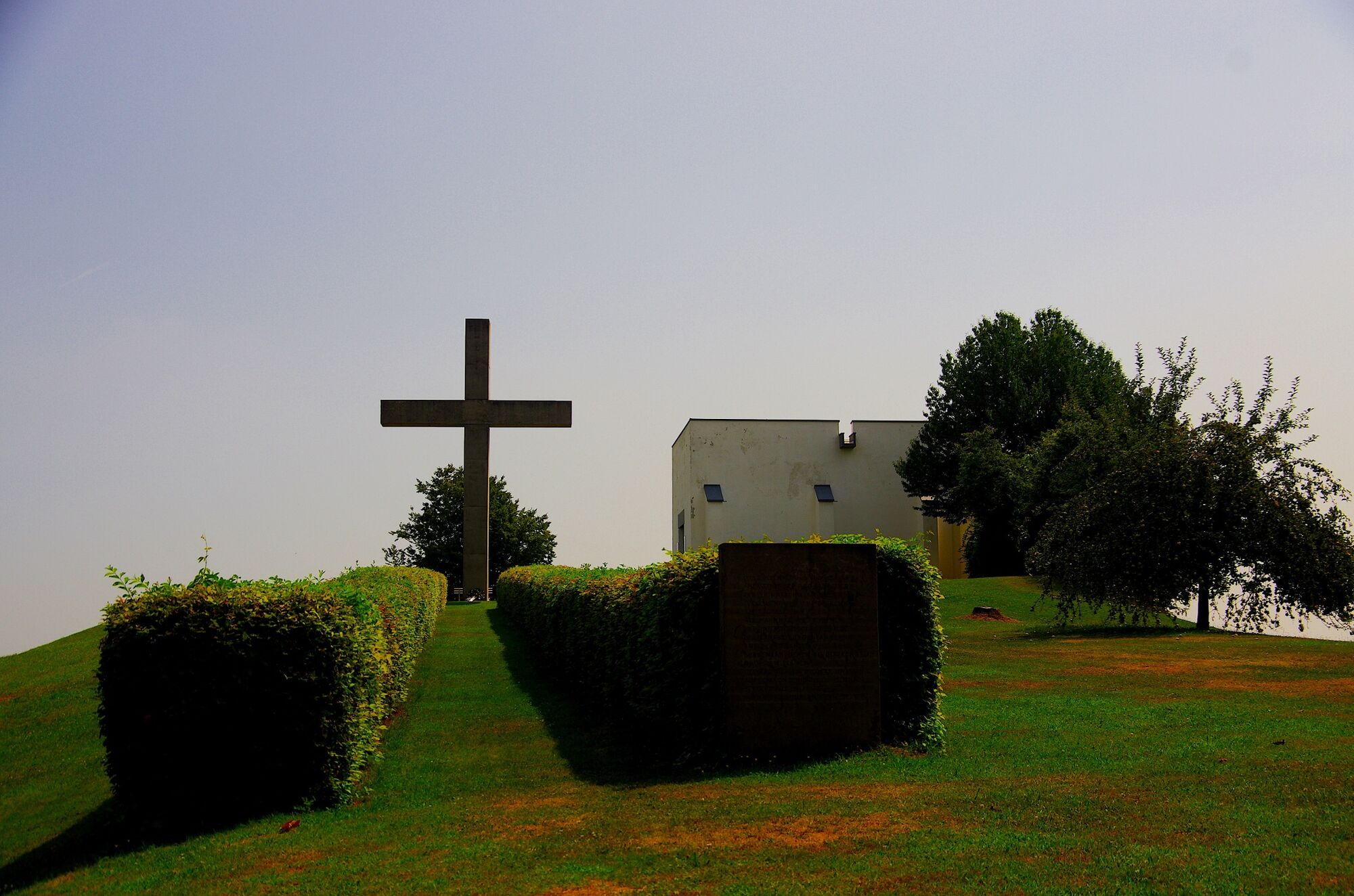
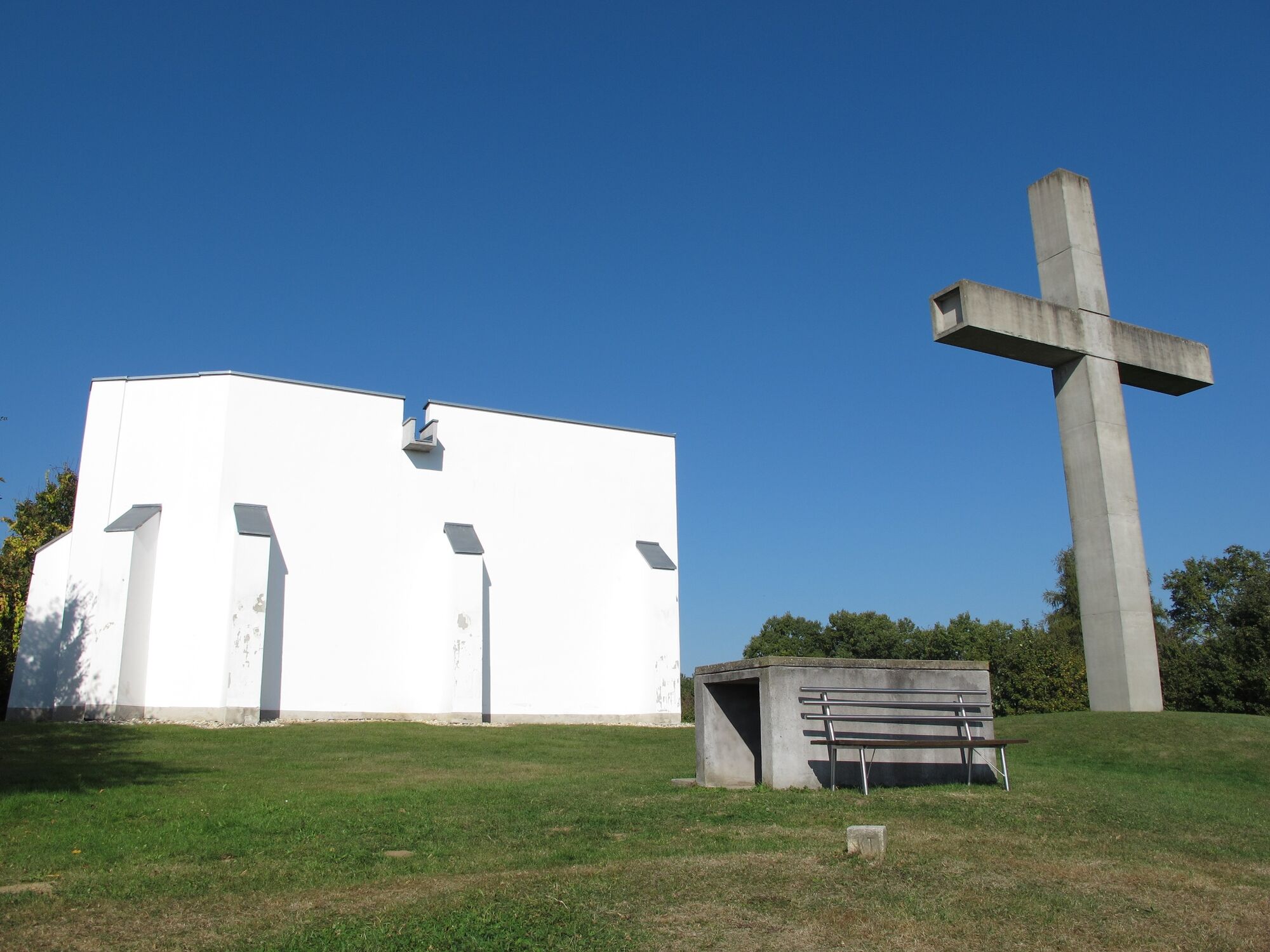
To the connection point, follow the first km of the mill tour (FF14). Medium-difficulty route, very wooded. Leads to the Schlösslberg in Mogersdorf. In addition to the wonderful panoramic view to Hungary and Slovenia, the exhibition about the Battle of the Turks in Mogersdorf is also worth seeing.
- Vaikeus
-
tapa
- Arviointi
-
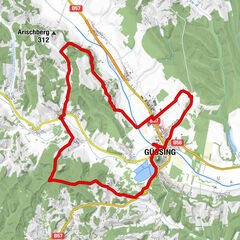
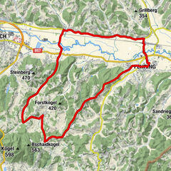
- Reitti
-
Hirczy-Kapelle1,0 kmOberhenndorf2,3 kmBücsek-Kapelle2,9 kmMitterhenndorf4,1 kmUnterhenndorf5,0 kmRosendorf9,7 kmOrtskapelle zur Hl. Dreifaltigkeit11,8 kmWallendorf11,9 kmDeutsch Minihof12,7 kmKreuzstadel am Schlösselberg14,6 kmSchlößlberg15,0 kmMogersdorf16,4 kmPfarrkirche hl. Josef16,7 kmGasthaus Josef Gottsnahm16,7 kmAnnakapelle17,2 kmMaria Bild21,8 kmLandRastHaus Maria Bild21,8 kmHobischberg23,3 kmRax-Bergen23,7 kmRax (240 m)26,6 kmJennersdorf28,8 kmGrieselstein31,0 kmGrieselgraben34,0 km
- Paras kausi
-
tammihelmimaalishuhtitoukokesäheinäelosyyslokamarrasjoulu
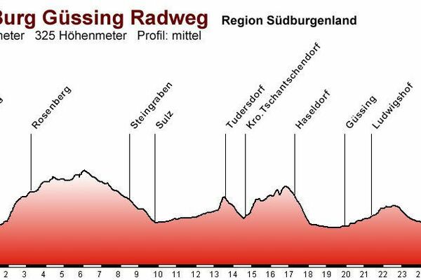
- Korkein kohta
- 371 m
- Kohde
-
Spa Loipersdorf
- Korkeusprofiili
-

-

-
KirjoittajaKiertue B71 Thermal spa bike path/Region Jennersdorf käyttää outdooractive.com toimitettu.
GPS Downloads


Yleistä tietoa
Virvokepysäkki
Kulttuuri/Historiallinen
Lupaava
Lisää retkiä alueilla
-
Thermen- & Vulkanland
344
-
Südburgenland
127
-
Weichselbaum
25