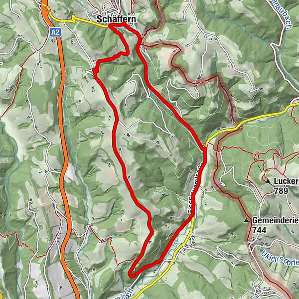
HWW-Hiking route: Schäffern - Bärnegg - Laglmühle (circular trail)


© Oststeiermark Tourismus - XKarin Hofer
- Lyhyt kuvaus
-
This HWW hiking route is part of the Wechselland Historical Long-Distance Hiking Trail (HWW), which tells the story of Wechselland along more than 100 HWW stations. More information can be found at www.wechsel-wandern.at.
- Vaikeus
-
tapa
- Arviointi
-
- Reitti
-
Gasthaus zum KirchenwirtPfarrkircheSchäffern0,1 kmElsenau6,6 kmGasthof Laglmühle8,4 kmLaglmühle8,5 kmGasthaus zum Kirchenwirt11,1 kmPfarrkirche11,2 kmSchäffern11,3 km
- Paras kausi
-
tammihelmimaalishuhtitoukokesäheinäelosyyslokamarrasjoulu
- Korkein kohta
- 755 m
- Kohde
-
Schäffern
- Korkeusprofiili
-


-

-
KirjoittajaKiertue HWW-Hiking route: Schäffern - Bärnegg - Laglmühle (circular trail) käyttää outdooractive.com toimitettu.
GPS Downloads


Yleistä tietoa
Kulttuuri/Historiallinen
Lisää retkiä alueilla
-
Wiener Alpen
3018
-
Kräuterregion Wechselland
1068
-
Schäffern
285