© Erlebnisregion Schladming-Dachstein - Schladming Dachstein
- Lyhyt kuvaus
-
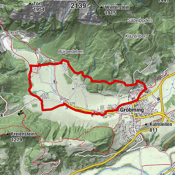
The Panorama Trail is easy and not too demanding. But as the name suggests, it is a "must do" for all passionate runners because of the magnificent panorama around Gröbming.
- Vaikeus
-
helppo
- Arviointi
-
- Reitti
-
GröbmingFriedfofskapelle0,0 kmHofmanning0,5 kmWeyern4,5 kmJausenstation Stodermaut5,8 kmWinkl6,8 kmGröbming9,1 kmFriedfofskapelle9,3 km
- Paras kausi
-
tammihelmimaalishuhtitoukokesäheinäelosyyslokamarrasjoulu
- Korkein kohta
- 913 m
- Kohde
-
Gröbming - Parkplatz gegenüber der Polizei
- Korkeusprofiili
-


- Kirjoittaja
-
Kiertue Panorama Trail (Number 3) käyttää outdooractive.com toimitettu.