© Erlebnisregion Thermen- & Vulkanland - Infobüro Bad Waltersdorf

© Erlebnisregion Thermen- & Vulkanland - Ingrid Jansky

© Bad Waltersdorf - Ingrid Jansky
© Bad Waltersdorf - Thermenland Süd- & Oststeiermark Marketing GmbH
- Lyhyt kuvaus
-
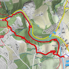
Discover the villages of Auffen, Großhart and Hohenbrugg and the natural paradise that surrounds them.
- Vaikeus
-
tapa
- Arviointi
-
- Reitti
-
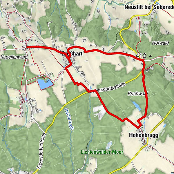
AuffenLindenhof StraußenwirtGroßhart1,2 kmHohenbrugg4,9 kmLinzbüchl7,5 kmGroßhart9,7 kmLindenhof Straußenwirt11,0 kmAuffen11,0 km
- Paras kausi
-
tammihelmimaalishuhtitoukokesäheinäelosyyslokamarrasjoulu
- Korkein kohta
- 449 m
- Kohde
-
In the center of Auffen
- Korkeusprofiili
-


-

-
KirjoittajaKiertue Hohenbrugg trail (Hohenbrugg-Weg) käyttää outdooractive.com toimitettu.
GPS Downloads


Yleistä tietoa
Virvokepysäkki
Fauna
Lisää retkiä alueilla
-
Thermen- & Vulkanland
1324
-
Bad Waltersdorf
624
-
Ebersdorf
195