
- Lyhyt kuvaus
-
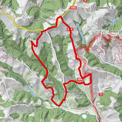
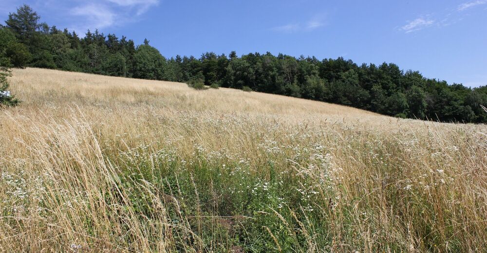
This hike leads past the Waldschachersee lake, along orchards and through woodland up to the Demmerkogel, the highest point of the hike at 671m. From there, the trail leads across the butterfly meadow back to Neudorf im Sausal.
- Vaikeus
-
vaikea
- Arviointi
-
- Reitti
-
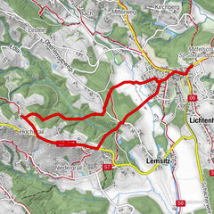
Neudorf im Sausal0,0 kmGensenberg1,7 kmBuschenschank Stelzer1,7 kmWeingut & Buschenschank Schmölzer3,6 kmAltkerschegg4,1 kmMandlkogel (596 m)6,1 kmKreuzegg6,9 kmSausalerhof7,1 kmKlapotetz7,4 kmDemmerkogel (671 m)8,2 kmSchmalegg10,9 kmFarm13,8 kmHochsausal15,1 kmKleinneudorf16,5 kmNeudorf im Sausal17,1 km
- Paras kausi
-
tammihelmimaalishuhtitoukokesäheinäelosyyslokamarrasjoulu
- Korkein kohta
- 667 m
- Kohde
-
Neudorf i.S.
- Korkeusprofiili
-


- Kirjoittaja
-
Kiertue Neudorf-Demmerkogel Round No. 22 käyttää outdooractive.com toimitettu.
GPS Downloads


Yleistä tietoa
Virvokepysäkki
Lupaava
Lisää retkiä alueilla
-
Südsteiermark
1135
-
Schilcherland Steiermark
1100
-
Sulmtal - Sausal
227